You are here: Home > Network List > CI - Caltech Regional Seismic Network Stations List
> Station SMM Simmler, CA, USA > Earthquake Result Viewer
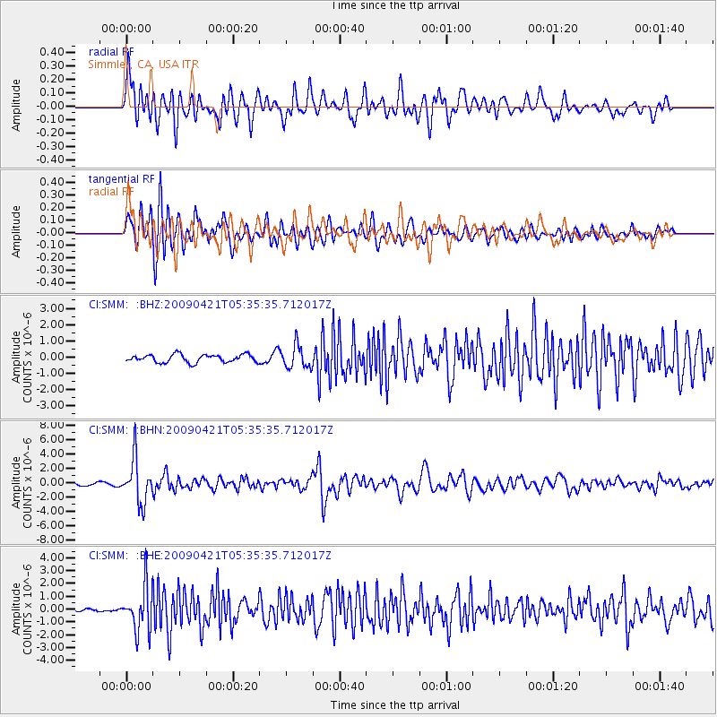
SMM Simmler, CA, USA - Earthquake Result Viewer
*The percent match for this event was below the threshold and hence no stack was calculated.
| Earthquake location: |
Kuril Islands |
| Earthquake latitude/longitude: |
50.8/155.0 |
| Earthquake time(UTC): |
2009/04/21 (111) 05:26:11 GMT |
| Earthquake Depth: |
152 km |
| Earthquake Magnitude: |
6.0 MB, 6.2 MW, 6.2 MW |
| Earthquake Catalog/Contributor: |
WHDF/NEIC |
|
| Network: |
CI Caltech Regional Seismic Network |
| Station: |
SMM Simmler, CA, USA |
| Lat/Lon: |
35.31 N/120.00 W |
| Elevation: |
599 m |
|
| Distance: |
60.6 deg |
| Az: |
69.183 deg |
| Baz: |
313.55 deg |
| Ray Param: |
$rayparam |
*The percent match for this event was below the threshold and hence was not used in the summary stack. |
|
| Radial Match: |
78.11422 % |
| Radial Bump: |
400 |
| Transverse Match: |
77.993385 % |
| Transverse Bump: |
400 |
| SOD ConfigId: |
2658 |
| Insert Time: |
2010-02-26 01:33:19.870 +0000 |
| GWidth: |
2.5 |
| Max Bumps: |
400 |
| Tol: |
0.001 |
|
Signal To Noise
| Channel | StoN | STA | LTA |
| CI:SMM: :BHN:20090421T05:35:35.712017Z | 12.550343 | 3.1124425E-6 | 2.4799664E-7 |
| CI:SMM: :BHE:20090421T05:35:35.712017Z | 8.391231 | 1.7501286E-6 | 2.0856638E-7 |
| CI:SMM: :BHZ:20090421T05:35:35.712017Z | 2.9065044 | 7.039784E-7 | 2.4220793E-7 |
| Arrivals |
| Ps | |
| PpPs | |
| PsPs/PpSs | |


