
T18A Mexican Hat, UT, USA - Earthquake Result Viewer
| ||||||||||||||||||
| ||||||||||||||||||
| ||||||||||||||||||
|
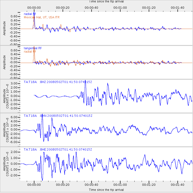
Signal To Noise
| Channel | StoN | STA | LTA |
| TA:T18A: :BHN:20080502T01:41:50.074015Z | 5.1954885 | 1.4751723E-6 | 2.8393333E-7 |
| TA:T18A: :BHE:20080502T01:41:50.074015Z | 4.057376 | 5.9330836E-7 | 1.4622958E-7 |
| TA:T18A: :BHZ:20080502T01:41:50.074015Z | 3.9634597 | 5.754363E-7 | 1.4518534E-7 |
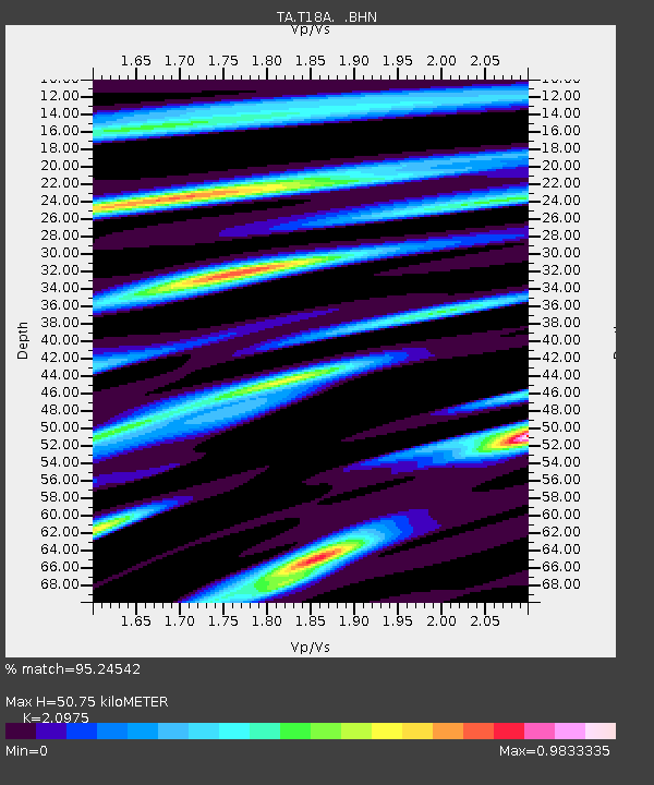
| Arrivals | |
| Ps | 9.1 SECOND |
| PpPs | 23 SECOND |
| PsPs/PpSs | 32 SECOND |

