T18A Mexican Hat, UT, USA - Earthquake Result Viewer
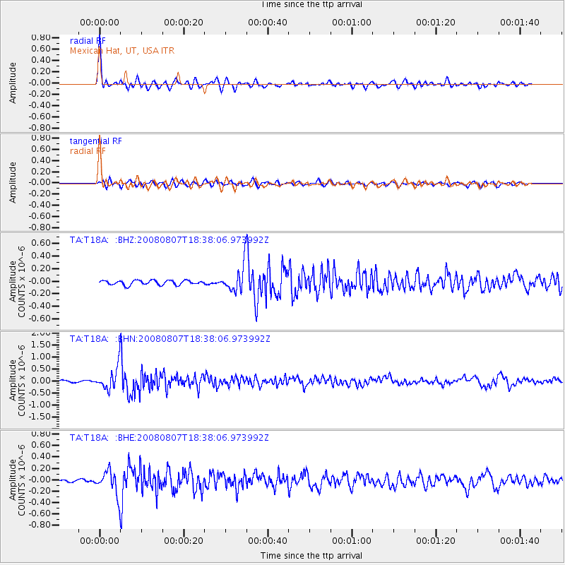
Earthquake location: Andreanof Islands, Aleutian Is.
Earthquake latitude/longitude: 52.2/-175.7
Earthquake time(UTC): 2008/08/07 (220) 18:30:03 GMT
Earthquake Depth: 12 km
Earthquake Magnitude: 5.6 MB, 5.5 MS, 5.8 MW, 5.8 MW
Earthquake Catalog/Contributor: WHDF/NEIC
Network: TA USArray Transportable Network (new EarthScope stations)
Station: T18A Mexican Hat, UT, USA
Lat/Lon: 37.14 N/109.87 W
Elevation: 1297 m
Distance: 47.5 deg
Az: 81.288 deg
Baz: 310.408 deg
Ray Param: 0.06994227
Estimated Moho Depth: 51.0 km
Estimated Crust Vp/Vs: 2.10
Assumed Crust Vp: 6.476 km/s
Estimated Crust Vs: 3.087 km/s
Estimated Crust Poisson's Ratio: 0.35
Radial Match: 90.26755 %
Radial Bump: 400
Transverse Match: 72.87127 %
Transverse Bump: 400
SOD ConfigId: 2504
Insert Time: 2010-03-06 05:35:31.228 +0000
GWidth: 2.5
Max Bumps: 400
Tol: 0.001

Signal To Noise

ChannelStoNSTALTA
TA:T18A: :BHN:20080807T18:38:06.973992Z8.2593784.79014E-75.7996367E-8
TA:T18A: :BHE:20080807T18:38:06.973992Z11.0234112.1862587E-71.9832868E-8
TA:T18A: :BHZ:20080807T18:38:06.973992Z6.1610882.1640561E-73.512458E-8
Arrivals
Ps9.1 SECOND
PpPs23 SECOND
PsPs/PpSs32 SECOND