You are here: Home > Network List > TA - USArray Transportable Network (new EarthScope stations) Stations List
> Station R31K City Hall, Gustavus, AK, USA > Earthquake Result Viewer
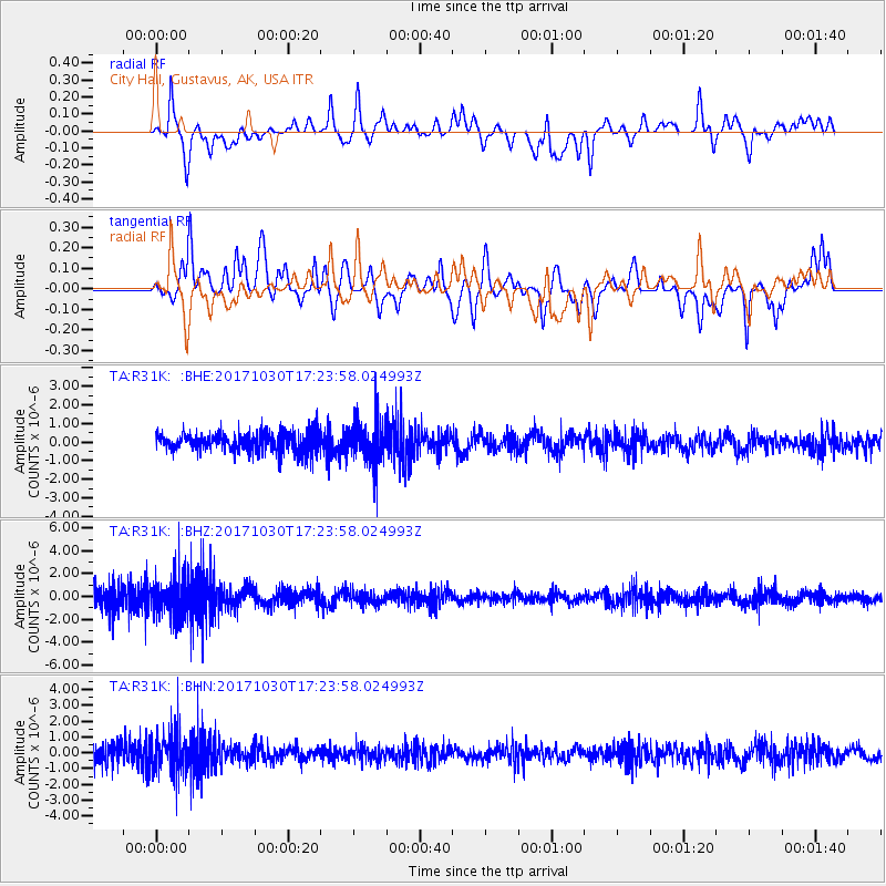
R31K City Hall, Gustavus, AK, USA - Earthquake Result Viewer
*The percent match for this event was below the threshold and hence no stack was calculated.
| Earthquake location: |
Central Peru |
| Earthquake latitude/longitude: |
-10.7/-74.7 |
| Earthquake time(UTC): |
2017/10/30 (303) 17:12:06 GMT |
| Earthquake Depth: |
101 km |
| Earthquake Magnitude: |
5.7 mb |
| Earthquake Catalog/Contributor: |
NEIC PDE/us |
|
| Network: |
TA USArray Transportable Network (new EarthScope stations) |
| Station: |
R31K City Hall, Gustavus, AK, USA |
| Lat/Lon: |
58.41 N/135.74 W |
| Elevation: |
15 m |
|
| Distance: |
84.7 deg |
| Az: |
332.447 deg |
| Baz: |
120.272 deg |
| Ray Param: |
$rayparam |
*The percent match for this event was below the threshold and hence was not used in the summary stack. |
|
| Radial Match: |
44.889435 % |
| Radial Bump: |
400 |
| Transverse Match: |
56.414658 % |
| Transverse Bump: |
400 |
| SOD ConfigId: |
13570011 |
| Insert Time: |
2019-04-29 01:11:39.019 +0000 |
| GWidth: |
2.5 |
| Max Bumps: |
400 |
| Tol: |
0.001 |
|
Signal To Noise
| Channel | StoN | STA | LTA |
| TA:R31K: :BHZ:20171030T17:23:58.024993Z | 2.261816 | 1.758069E-6 | 7.77282E-7 |
| TA:R31K: :BHN:20171030T17:23:58.024993Z | 2.2303073 | 1.2720528E-6 | 5.703487E-7 |
| TA:R31K: :BHE:20171030T17:23:58.024993Z | 2.2245307 | 1.191705E-6 | 5.357107E-7 |
| Arrivals |
| Ps | |
| PpPs | |
| PsPs/PpSs | |


