You are here: Home > Network List > TA - USArray Transportable Network (new EarthScope stations) Stations List
> Station J20K Nowitna River, AK, USA > Earthquake Result Viewer
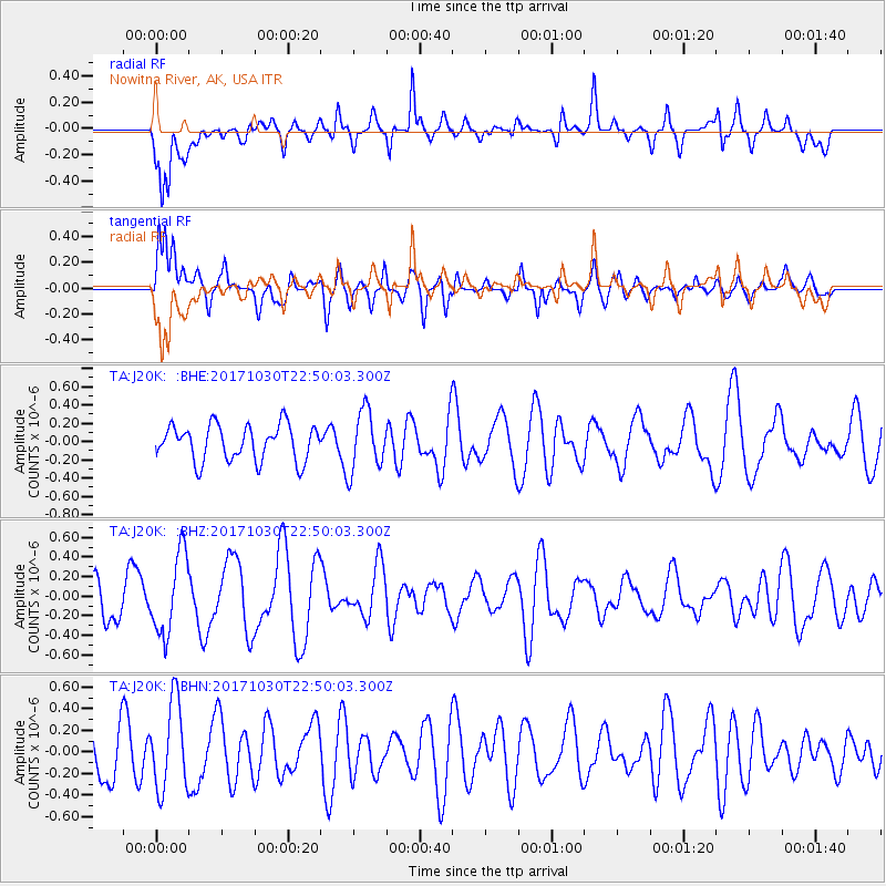
J20K Nowitna River, AK, USA - Earthquake Result Viewer
*The percent match for this event was below the threshold and hence no stack was calculated.
| Earthquake location: |
Sumbawa Region, Indonesia |
| Earthquake latitude/longitude: |
-8.6/119.0 |
| Earthquake time(UTC): |
2017/10/30 (303) 22:37:18 GMT |
| Earthquake Depth: |
110 km |
| Earthquake Magnitude: |
5.5 mb |
| Earthquake Catalog/Contributor: |
NEIC PDE/us |
|
| Network: |
TA USArray Transportable Network (new EarthScope stations) |
| Station: |
J20K Nowitna River, AK, USA |
| Lat/Lon: |
64.18 N/154.15 W |
| Elevation: |
314 m |
|
| Distance: |
96.3 deg |
| Az: |
26.103 deg |
| Baz: |
263.436 deg |
| Ray Param: |
$rayparam |
*The percent match for this event was below the threshold and hence was not used in the summary stack. |
|
| Radial Match: |
67.17492 % |
| Radial Bump: |
400 |
| Transverse Match: |
52.079502 % |
| Transverse Bump: |
400 |
| SOD ConfigId: |
13570011 |
| Insert Time: |
2019-04-29 01:15:06.601 +0000 |
| GWidth: |
2.5 |
| Max Bumps: |
400 |
| Tol: |
0.001 |
|
Signal To Noise
| Channel | StoN | STA | LTA |
| TA:J20K: :BHZ:20171030T22:50:03.300Z | 1.7781265 | 4.0911846E-7 | 2.3008401E-7 |
| TA:J20K: :BHN:20171030T22:50:03.300Z | 1.2250983 | 4.0372458E-7 | 3.2954466E-7 |
| TA:J20K: :BHE:20171030T22:50:03.300Z | 1.6665579 | 3.2503746E-7 | 1.950352E-7 |
| Arrivals |
| Ps | |
| PpPs | |
| PsPs/PpSs | |


