You are here: Home > Network List > AK - Alaska Regional Network Stations List
> Station MDM Murphy Dome > Earthquake Result Viewer
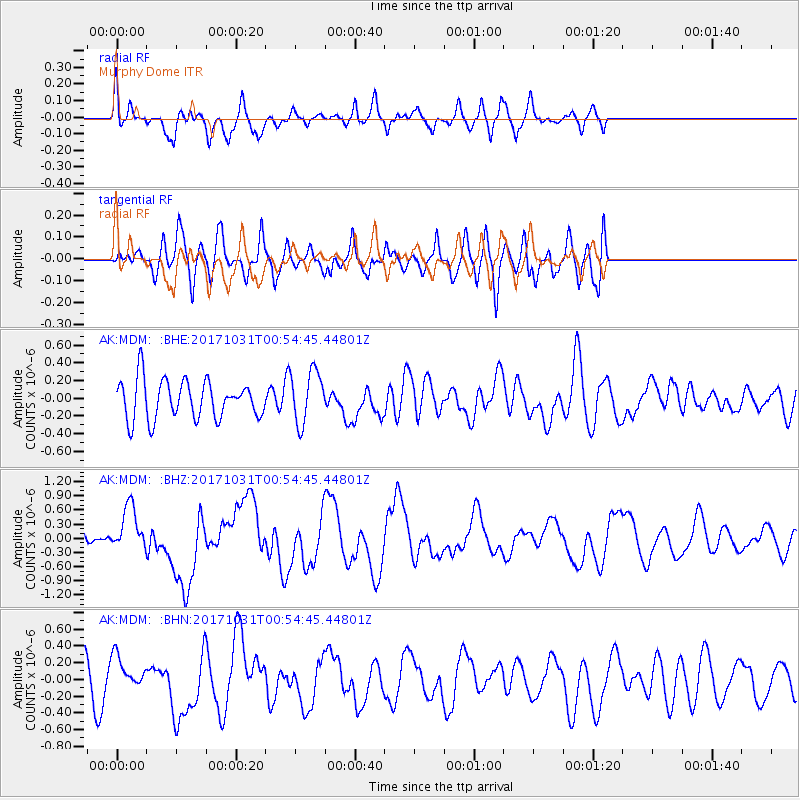
MDM Murphy Dome - Earthquake Result Viewer
*The percent match for this event was below the threshold and hence no stack was calculated.
| Earthquake location: |
Southeast Of Loyalty Islands |
| Earthquake latitude/longitude: |
-21.7/169.2 |
| Earthquake time(UTC): |
2017/10/31 (304) 00:42:06 GMT |
| Earthquake Depth: |
9.1 km |
| Earthquake Magnitude: |
6.8 Mww |
| Earthquake Catalog/Contributor: |
NEIC PDE/us |
|
| Network: |
AK Alaska Regional Network |
| Station: |
MDM Murphy Dome |
| Lat/Lon: |
64.96 N/148.23 W |
| Elevation: |
634 m |
|
| Distance: |
92.3 deg |
| Az: |
16.745 deg |
| Baz: |
219.028 deg |
| Ray Param: |
$rayparam |
*The percent match for this event was below the threshold and hence was not used in the summary stack. |
|
| Radial Match: |
59.045727 % |
| Radial Bump: |
400 |
| Transverse Match: |
51.19271 % |
| Transverse Bump: |
400 |
| SOD ConfigId: |
13570011 |
| Insert Time: |
2019-04-29 01:16:16.413 +0000 |
| GWidth: |
2.5 |
| Max Bumps: |
400 |
| Tol: |
0.001 |
|
Signal To Noise
| Channel | StoN | STA | LTA |
| AK:MDM: :BHZ:20171031T00:54:45.44801Z | 3.119484 | 4.813757E-7 | 1.543126E-7 |
| AK:MDM: :BHN:20171031T00:54:45.44801Z | 0.6728479 | 1.9259286E-7 | 2.8623535E-7 |
| AK:MDM: :BHE:20171031T00:54:45.44801Z | 1.3797976 | 3.0091562E-7 | 2.1808678E-7 |
| Arrivals |
| Ps | |
| PpPs | |
| PsPs/PpSs | |


