BBR Big Bear Solar Observatory - Earthquake Result Viewer
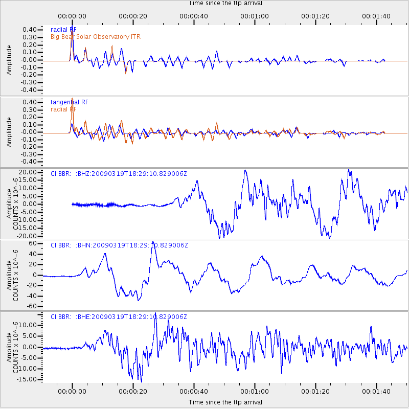
Earthquake location: Tonga Islands Region
Earthquake latitude/longitude: -23.0/-174.7
Earthquake time(UTC): 2009/03/19 (078) 18:17:40 GMT
Earthquake Depth: 34 km
Earthquake Magnitude: 7.0 MB, 7.6 MS, 7.6 MW, 7.6 MW
Earthquake Catalog/Contributor: WHDF/NEIC
Network: CI Caltech Regional Seismic Network
Station: BBR Big Bear Solar Observatory
Lat/Lon: 34.26 N/116.92 W
Elevation: 2069 m
Distance: 79.1 deg
Az: 45.498 deg
Baz: 232.489 deg
Ray Param: 0.04914469
Estimated Moho Depth: 29.25 km
Estimated Crust Vp/Vs: 1.94
Assumed Crust Vp: 6.276 km/s
Estimated Crust Vs: 3.239 km/s
Estimated Crust Poisson's Ratio: 0.32
Radial Match: 96.01697 %
Radial Bump: 400
Transverse Match: 87.83186 %
Transverse Bump: 400
SOD ConfigId: 2658
Insert Time: 2010-02-26 01:33:33.797 +0000
GWidth: 2.5
Max Bumps: 400
Tol: 0.001

Signal To Noise

ChannelStoNSTALTA
CI:BBR: :BHN:20090319T18:29:10.829006Z11.3223646.5274976E-65.765137E-7
CI:BBR: :BHE:20090319T18:29:10.829006Z2.20212677.797531E-73.5409096E-7
CI:BBR: :BHZ:20090319T18:29:10.829006Z4.6428282.1416893E-64.612898E-7
Arrivals
Ps4.5 SECOND
PpPs13 SECOND
PsPs/PpSs18 SECOND