You are here: Home > Network List > TA - USArray Transportable Network (new EarthScope stations) Stations List
> Station H24K Noodor Dome, AK, USA > Earthquake Result Viewer
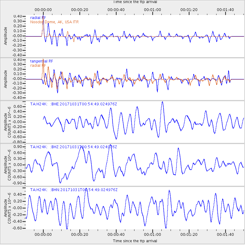
H24K Noodor Dome, AK, USA - Earthquake Result Viewer
*The percent match for this event was below the threshold and hence no stack was calculated.
| Earthquake location: |
Southeast Of Loyalty Islands |
| Earthquake latitude/longitude: |
-21.7/169.2 |
| Earthquake time(UTC): |
2017/10/31 (304) 00:42:06 GMT |
| Earthquake Depth: |
9.1 km |
| Earthquake Magnitude: |
6.8 Mww |
| Earthquake Catalog/Contributor: |
NEIC PDE/us |
|
| Network: |
TA USArray Transportable Network (new EarthScope stations) |
| Station: |
H24K Noodor Dome, AK, USA |
| Lat/Lon: |
65.84 N/147.88 W |
| Elevation: |
814 m |
|
| Distance: |
93.1 deg |
| Az: |
16.301 deg |
| Baz: |
219.368 deg |
| Ray Param: |
$rayparam |
*The percent match for this event was below the threshold and hence was not used in the summary stack. |
|
| Radial Match: |
62.656128 % |
| Radial Bump: |
370 |
| Transverse Match: |
54.16995 % |
| Transverse Bump: |
400 |
| SOD ConfigId: |
13570011 |
| Insert Time: |
2019-04-29 01:20:38.674 +0000 |
| GWidth: |
2.5 |
| Max Bumps: |
400 |
| Tol: |
0.001 |
|
Signal To Noise
| Channel | StoN | STA | LTA |
| TA:H24K: :BHZ:20171031T00:54:49.024976Z | 2.5087743 | 4.3290362E-7 | 1.7255583E-7 |
| TA:H24K: :BHN:20171031T00:54:49.024976Z | 0.5991261 | 1.4850781E-7 | 2.4787403E-7 |
| TA:H24K: :BHE:20171031T00:54:49.024976Z | 1.1874189 | 1.6556803E-7 | 1.3943523E-7 |
| Arrivals |
| Ps | |
| PpPs | |
| PsPs/PpSs | |


