You are here: Home > Network List > TA - USArray Transportable Network (new EarthScope stations) Stations List
> Station L20K Farewell, AK, USA > Earthquake Result Viewer
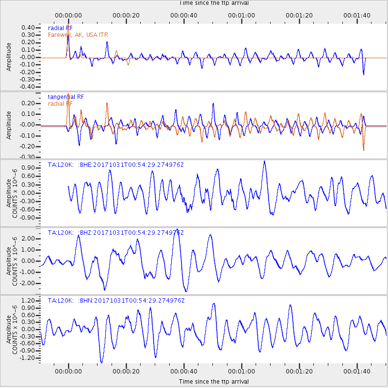
L20K Farewell, AK, USA - Earthquake Result Viewer
*The percent match for this event was below the threshold and hence no stack was calculated.
| Earthquake location: |
Southeast Of Loyalty Islands |
| Earthquake latitude/longitude: |
-21.7/169.2 |
| Earthquake time(UTC): |
2017/10/31 (304) 00:42:06 GMT |
| Earthquake Depth: |
9.1 km |
| Earthquake Magnitude: |
6.8 Mww |
| Earthquake Catalog/Contributor: |
NEIC PDE/us |
|
| Network: |
TA USArray Transportable Network (new EarthScope stations) |
| Station: |
L20K Farewell, AK, USA |
| Lat/Lon: |
62.48 N/153.88 W |
| Elevation: |
673 m |
|
| Distance: |
88.8 deg |
| Az: |
16.203 deg |
| Baz: |
213.971 deg |
| Ray Param: |
$rayparam |
*The percent match for this event was below the threshold and hence was not used in the summary stack. |
|
| Radial Match: |
68.052414 % |
| Radial Bump: |
400 |
| Transverse Match: |
54.56936 % |
| Transverse Bump: |
400 |
| SOD ConfigId: |
13570011 |
| Insert Time: |
2019-04-29 01:20:54.714 +0000 |
| GWidth: |
2.5 |
| Max Bumps: |
400 |
| Tol: |
0.001 |
|
Signal To Noise
| Channel | StoN | STA | LTA |
| TA:L20K: :BHZ:20171031T00:54:29.274976Z | 3.763208 | 1.1134738E-6 | 2.958842E-7 |
| TA:L20K: :BHN:20171031T00:54:29.274976Z | 0.72078985 | 1.9750689E-7 | 2.7401452E-7 |
| TA:L20K: :BHE:20171031T00:54:29.274976Z | 1.1412859 | 4.1199334E-7 | 3.609905E-7 |
| Arrivals |
| Ps | |
| PpPs | |
| PsPs/PpSs | |


