You are here: Home > Network List > TA - USArray Transportable Network (new EarthScope stations) Stations List
> Station T18A Mexican Hat, UT, USA > Earthquake Result Viewer
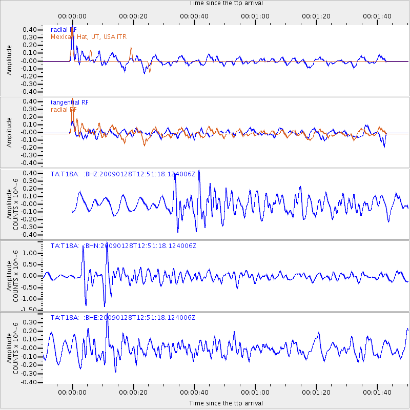
T18A Mexican Hat, UT, USA - Earthquake Result Viewer
*The percent match for this event was below the threshold and hence no stack was calculated.
| Earthquake location: |
Samoa Islands Region |
| Earthquake latitude/longitude: |
-17.0/-172.1 |
| Earthquake time(UTC): |
2009/01/28 (028) 12:39:42 GMT |
| Earthquake Depth: |
10 km |
| Earthquake Magnitude: |
5.6 MB, 5.3 MS, 5.5 MW |
| Earthquake Catalog/Contributor: |
WHDF/NEIC |
|
| Network: |
TA USArray Transportable Network (new EarthScope stations) |
| Station: |
T18A Mexican Hat, UT, USA |
| Lat/Lon: |
37.14 N/109.87 W |
| Elevation: |
1297 m |
|
| Distance: |
79.5 deg |
| Az: |
45.966 deg |
| Baz: |
239.42 deg |
| Ray Param: |
$rayparam |
*The percent match for this event was below the threshold and hence was not used in the summary stack. |
|
| Radial Match: |
69.04621 % |
| Radial Bump: |
400 |
| Transverse Match: |
51.763103 % |
| Transverse Bump: |
400 |
| SOD ConfigId: |
2658 |
| Insert Time: |
2010-03-06 05:37:34.682 +0000 |
| GWidth: |
2.5 |
| Max Bumps: |
400 |
| Tol: |
0.001 |
|
Signal To Noise
| Channel | StoN | STA | LTA |
| TA:T18A: :BHN:20090128T12:51:18.124006Z | 4.233545 | 5.4328643E-7 | 1.2832896E-7 |
| TA:T18A: :BHE:20090128T12:51:18.124006Z | 1.7285733 | 1.2003541E-7 | 6.9441896E-8 |
| TA:T18A: :BHZ:20090128T12:51:18.124006Z | 2.3011281 | 1.7167862E-7 | 7.4606284E-8 |
| Arrivals |
| Ps | |
| PpPs | |
| PsPs/PpSs | |


