You are here: Home > Network List > AK - Alaska Regional Network Stations List
> Station CUT Chulitna, AK, USA > Earthquake Result Viewer
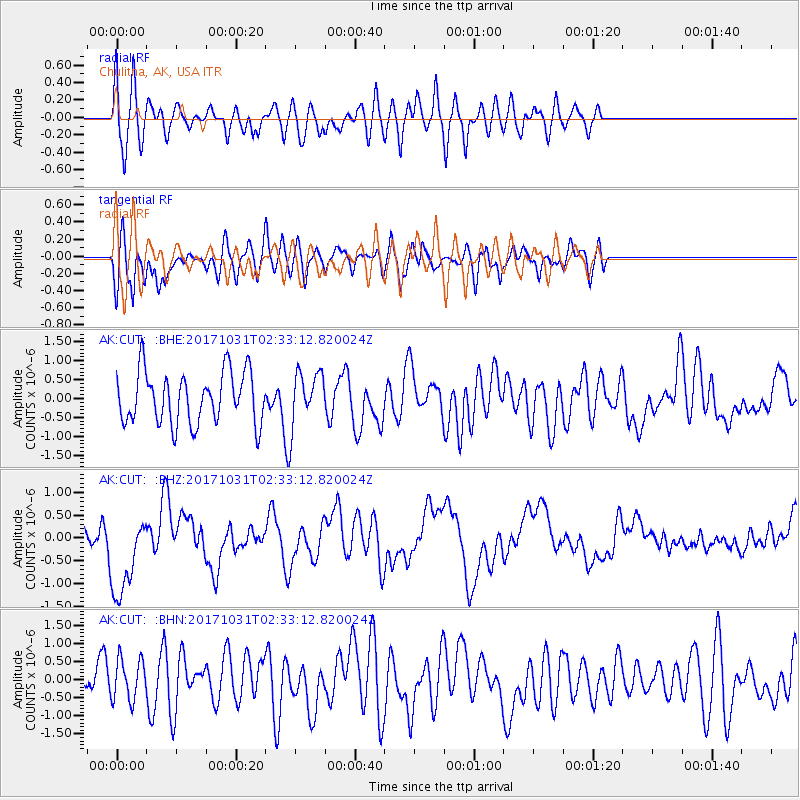
CUT Chulitna, AK, USA - Earthquake Result Viewer
*The percent match for this event was below the threshold and hence no stack was calculated.
| Earthquake location: |
Loyalty Islands |
| Earthquake latitude/longitude: |
-21.5/168.9 |
| Earthquake time(UTC): |
2017/10/31 (304) 02:20:46 GMT |
| Earthquake Depth: |
10 km |
| Earthquake Magnitude: |
5.9 Mww |
| Earthquake Catalog/Contributor: |
NEIC PDE/us |
|
| Network: |
AK Alaska Regional Network |
| Station: |
CUT Chulitna, AK, USA |
| Lat/Lon: |
62.41 N/150.26 W |
| Elevation: |
574 m |
|
| Distance: |
89.6 deg |
| Az: |
17.73 deg |
| Baz: |
217.529 deg |
| Ray Param: |
$rayparam |
*The percent match for this event was below the threshold and hence was not used in the summary stack. |
|
| Radial Match: |
67.87398 % |
| Radial Bump: |
400 |
| Transverse Match: |
71.6229 % |
| Transverse Bump: |
400 |
| SOD ConfigId: |
13570011 |
| Insert Time: |
2019-04-29 01:23:15.457 +0000 |
| GWidth: |
2.5 |
| Max Bumps: |
400 |
| Tol: |
0.001 |
|
Signal To Noise
| Channel | StoN | STA | LTA |
| AK:CUT: :BHZ:20171031T02:33:12.820024Z | 2.2709646 | 9.679708E-7 | 4.262377E-7 |
| AK:CUT: :BHN:20171031T02:33:12.820024Z | 0.86076653 | 5.7945925E-7 | 6.731898E-7 |
| AK:CUT: :BHE:20171031T02:33:12.820024Z | 1.0575882 | 7.2681564E-7 | 6.8723875E-7 |
| Arrivals |
| Ps | |
| PpPs | |
| PsPs/PpSs | |


