You are here: Home > Network List > AK - Alaska Regional Network Stations List
> Station CUT Chulitna, AK, USA > Earthquake Result Viewer
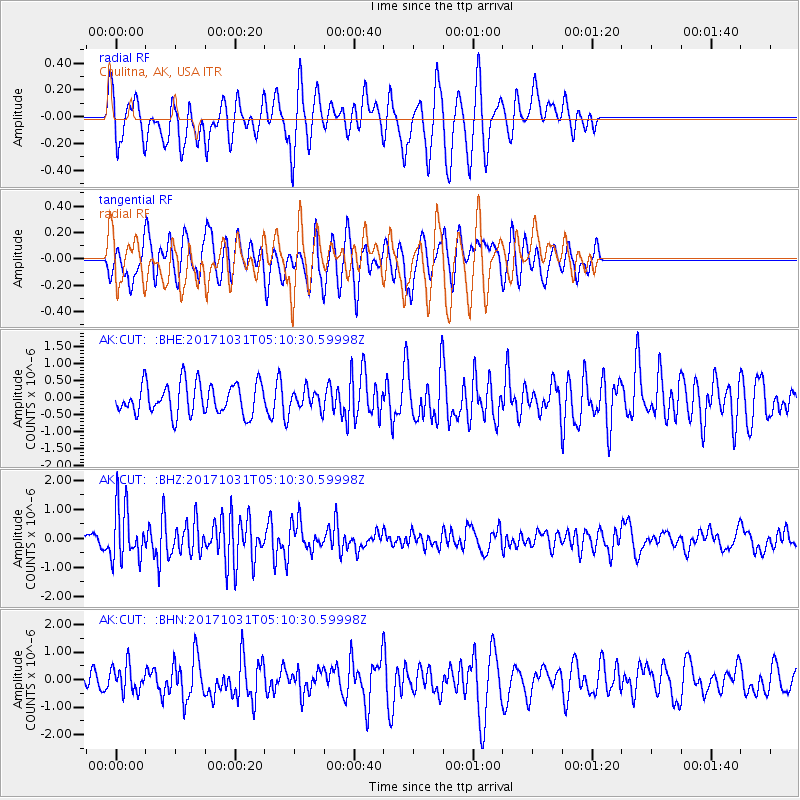
CUT Chulitna, AK, USA - Earthquake Result Viewer
*The percent match for this event was below the threshold and hence no stack was calculated.
| Earthquake location: |
Tonga Islands |
| Earthquake latitude/longitude: |
-15.5/-173.3 |
| Earthquake time(UTC): |
2017/10/31 (304) 04:58:58 GMT |
| Earthquake Depth: |
35 km |
| Earthquake Magnitude: |
5.8 mb |
| Earthquake Catalog/Contributor: |
NEIC PDE/us |
|
| Network: |
AK Alaska Regional Network |
| Station: |
CUT Chulitna, AK, USA |
| Lat/Lon: |
62.41 N/150.26 W |
| Elevation: |
574 m |
|
| Distance: |
79.8 deg |
| Az: |
10.68 deg |
| Baz: |
202.559 deg |
| Ray Param: |
$rayparam |
*The percent match for this event was below the threshold and hence was not used in the summary stack. |
|
| Radial Match: |
56.126667 % |
| Radial Bump: |
400 |
| Transverse Match: |
53.706226 % |
| Transverse Bump: |
400 |
| SOD ConfigId: |
13570011 |
| Insert Time: |
2019-04-29 01:27:54.122 +0000 |
| GWidth: |
2.5 |
| Max Bumps: |
400 |
| Tol: |
0.001 |
|
Signal To Noise
| Channel | StoN | STA | LTA |
| AK:CUT: :BHZ:20171031T05:10:30.59998Z | 4.0910277 | 9.458242E-7 | 2.3119475E-7 |
| AK:CUT: :BHN:20171031T05:10:30.59998Z | 0.9935954 | 5.004592E-7 | 5.0368504E-7 |
| AK:CUT: :BHE:20171031T05:10:30.59998Z | 0.66919583 | 3.0585022E-7 | 4.570414E-7 |
| Arrivals |
| Ps | |
| PpPs | |
| PsPs/PpSs | |


