You are here: Home > Network List > CI - Caltech Regional Seismic Network Stations List
> Station MLAC Mammoth Lakes, California, USA > Earthquake Result Viewer
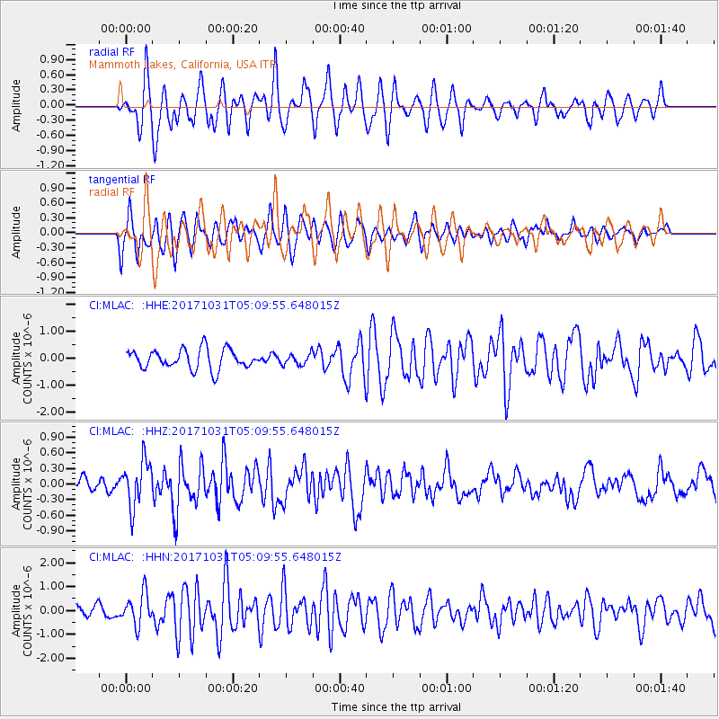
MLAC Mammoth Lakes, California, USA - Earthquake Result Viewer
*The percent match for this event was below the threshold and hence no stack was calculated.
| Earthquake location: |
Tonga Islands |
| Earthquake latitude/longitude: |
-15.5/-173.3 |
| Earthquake time(UTC): |
2017/10/31 (304) 04:58:58 GMT |
| Earthquake Depth: |
35 km |
| Earthquake Magnitude: |
5.8 mb |
| Earthquake Catalog/Contributor: |
NEIC PDE/us |
|
| Network: |
CI Caltech Regional Seismic Network |
| Station: |
MLAC Mammoth Lakes, California, USA |
| Lat/Lon: |
37.63 N/118.84 W |
| Elevation: |
2134 m |
|
| Distance: |
73.6 deg |
| Az: |
42.357 deg |
| Baz: |
234.886 deg |
| Ray Param: |
$rayparam |
*The percent match for this event was below the threshold and hence was not used in the summary stack. |
|
| Radial Match: |
70.27256 % |
| Radial Bump: |
400 |
| Transverse Match: |
64.29249 % |
| Transverse Bump: |
400 |
| SOD ConfigId: |
13570011 |
| Insert Time: |
2019-04-29 01:29:37.749 +0000 |
| GWidth: |
2.5 |
| Max Bumps: |
400 |
| Tol: |
0.001 |
|
Signal To Noise
| Channel | StoN | STA | LTA |
| CI:MLAC: :HHZ:20171031T05:09:55.648015Z | 3.8177452 | 4.3998557E-7 | 1.1524749E-7 |
| CI:MLAC: :HHN:20171031T05:09:55.648015Z | 2.4878545 | 6.711125E-7 | 2.6975553E-7 |
| CI:MLAC: :HHE:20171031T05:09:55.648015Z | 0.6139942 | 2.1961576E-7 | 3.5768377E-7 |
| Arrivals |
| Ps | |
| PpPs | |
| PsPs/PpSs | |


