You are here: Home > Network List > CI - Caltech Regional Seismic Network Stations List
> Station SMM Simmler, CA, USA > Earthquake Result Viewer
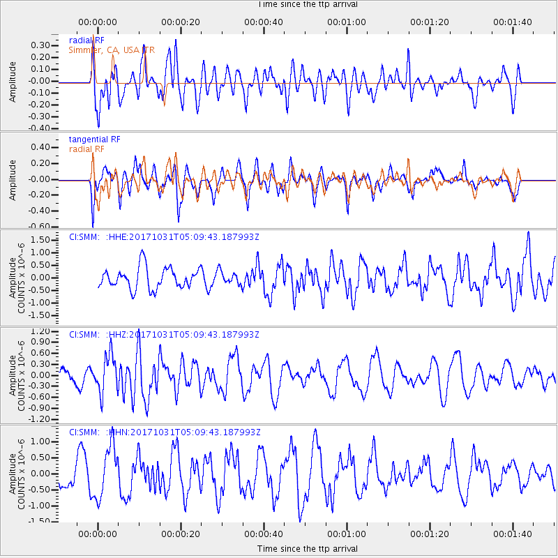
SMM Simmler, CA, USA - Earthquake Result Viewer
*The percent match for this event was below the threshold and hence no stack was calculated.
| Earthquake location: |
Tonga Islands |
| Earthquake latitude/longitude: |
-15.5/-173.3 |
| Earthquake time(UTC): |
2017/10/31 (304) 04:58:58 GMT |
| Earthquake Depth: |
35 km |
| Earthquake Magnitude: |
5.8 mb |
| Earthquake Catalog/Contributor: |
NEIC PDE/us |
|
| Network: |
CI Caltech Regional Seismic Network |
| Station: |
SMM Simmler, CA, USA |
| Lat/Lon: |
35.31 N/120.00 W |
| Elevation: |
599 m |
|
| Distance: |
71.5 deg |
| Az: |
43.77 deg |
| Baz: |
234.624 deg |
| Ray Param: |
$rayparam |
*The percent match for this event was below the threshold and hence was not used in the summary stack. |
|
| Radial Match: |
57.524418 % |
| Radial Bump: |
400 |
| Transverse Match: |
47.18326 % |
| Transverse Bump: |
400 |
| SOD ConfigId: |
13570011 |
| Insert Time: |
2019-04-29 01:29:51.144 +0000 |
| GWidth: |
2.5 |
| Max Bumps: |
400 |
| Tol: |
0.001 |
|
Signal To Noise
| Channel | StoN | STA | LTA |
| CI:SMM: :HHZ:20171031T05:09:43.187993Z | 2.936386 | 5.219195E-7 | 1.7774212E-7 |
| CI:SMM: :HHN:20171031T05:09:43.187993Z | 2.9677296 | 8.128527E-7 | 2.7389717E-7 |
| CI:SMM: :HHE:20171031T05:09:43.187993Z | 0.5141447 | 2.1490916E-7 | 4.1799353E-7 |
| Arrivals |
| Ps | |
| PpPs | |
| PsPs/PpSs | |


