You are here: Home > Network List > BK - Berkeley Digital Seismograph Network Stations List
> Station HUMO Hull Mountain, OR > Earthquake Result Viewer
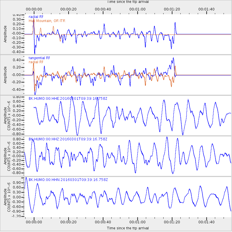
HUMO Hull Mountain, OR - Earthquake Result Viewer
*The percent match for this event was below the threshold and hence no stack was calculated.
| Earthquake location: |
South Of Kermadec Islands |
| Earthquake latitude/longitude: |
-32.9/-178.4 |
| Earthquake time(UTC): |
2016/03/01 (061) 09:26:45 GMT |
| Earthquake Depth: |
10 km |
| Earthquake Magnitude: |
5.6 MWW, 5.5 MWB, 5.7 MWC |
| Earthquake Catalog/Contributor: |
NEIC PDE/NEIC COMCAT |
|
| Network: |
BK Berkeley Digital Seismograph Network |
| Station: |
HUMO Hull Mountain, OR |
| Lat/Lon: |
42.61 N/122.96 W |
| Elevation: |
555 m |
|
| Distance: |
90.7 deg |
| Az: |
37.442 deg |
| Baz: |
223.828 deg |
| Ray Param: |
$rayparam |
*The percent match for this event was below the threshold and hence was not used in the summary stack. |
|
| Radial Match: |
69.52373 % |
| Radial Bump: |
400 |
| Transverse Match: |
76.825386 % |
| Transverse Bump: |
400 |
| SOD ConfigId: |
1474791 |
| Insert Time: |
2016-04-07 10:00:35.226 +0000 |
| GWidth: |
2.5 |
| Max Bumps: |
400 |
| Tol: |
0.001 |
|
Signal To Noise
| Channel | StoN | STA | LTA |
| BK:HUMO:00:HHZ:20160301T09:39:16.758Z | 1.8968285 | 4.9471697E-7 | 2.608127E-7 |
| BK:HUMO:00:HHN:20160301T09:39:16.758Z | 0.9842731 | 5.653803E-7 | 5.7441406E-7 |
| BK:HUMO:00:HHE:20160301T09:39:16.758Z | 0.7869379 | 2.8876056E-7 | 3.6694198E-7 |
| Arrivals |
| Ps | |
| PpPs | |
| PsPs/PpSs | |


