You are here: Home > Network List > TA - USArray Transportable Network (new EarthScope stations) Stations List
> Station H16K Elim, AK, USA > Earthquake Result Viewer
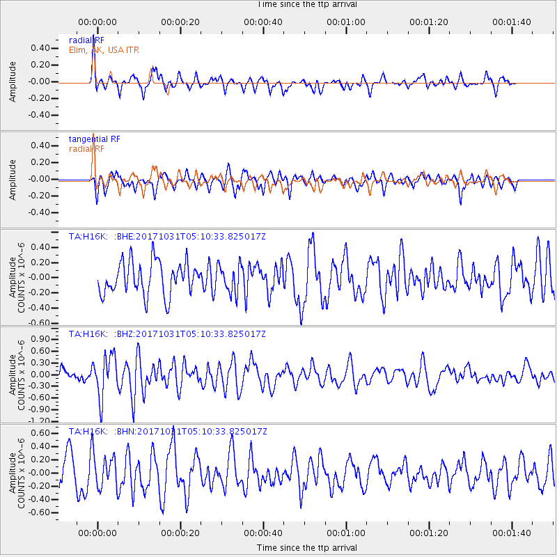
H16K Elim, AK, USA - Earthquake Result Viewer
*The percent match for this event was below the threshold and hence no stack was calculated.
| Earthquake location: |
Tonga Islands |
| Earthquake latitude/longitude: |
-15.5/-173.3 |
| Earthquake time(UTC): |
2017/10/31 (304) 04:58:58 GMT |
| Earthquake Depth: |
35 km |
| Earthquake Magnitude: |
5.8 mb |
| Earthquake Catalog/Contributor: |
NEIC PDE/us |
|
| Network: |
TA USArray Transportable Network (new EarthScope stations) |
| Station: |
H16K Elim, AK, USA |
| Lat/Lon: |
64.64 N/162.24 W |
| Elevation: |
216 m |
|
| Distance: |
80.4 deg |
| Az: |
4.816 deg |
| Baz: |
190.832 deg |
| Ray Param: |
$rayparam |
*The percent match for this event was below the threshold and hence was not used in the summary stack. |
|
| Radial Match: |
64.25335 % |
| Radial Bump: |
386 |
| Transverse Match: |
53.31636 % |
| Transverse Bump: |
375 |
| SOD ConfigId: |
13570011 |
| Insert Time: |
2019-04-29 01:34:02.514 +0000 |
| GWidth: |
2.5 |
| Max Bumps: |
400 |
| Tol: |
0.001 |
|
Signal To Noise
| Channel | StoN | STA | LTA |
| TA:H16K: :BHZ:20171031T05:10:33.825017Z | 2.854894 | 5.4630885E-7 | 1.9135874E-7 |
| TA:H16K: :BHN:20171031T05:10:33.825017Z | 0.97247154 | 2.1877808E-7 | 2.249712E-7 |
| TA:H16K: :BHE:20171031T05:10:33.825017Z | 0.93134636 | 1.9890759E-7 | 2.1356993E-7 |
| Arrivals |
| Ps | |
| PpPs | |
| PsPs/PpSs | |


