You are here: Home > Network List > TA - USArray Transportable Network (new EarthScope stations) Stations List
> Station H31M Peel River, Yukon, CAN > Earthquake Result Viewer
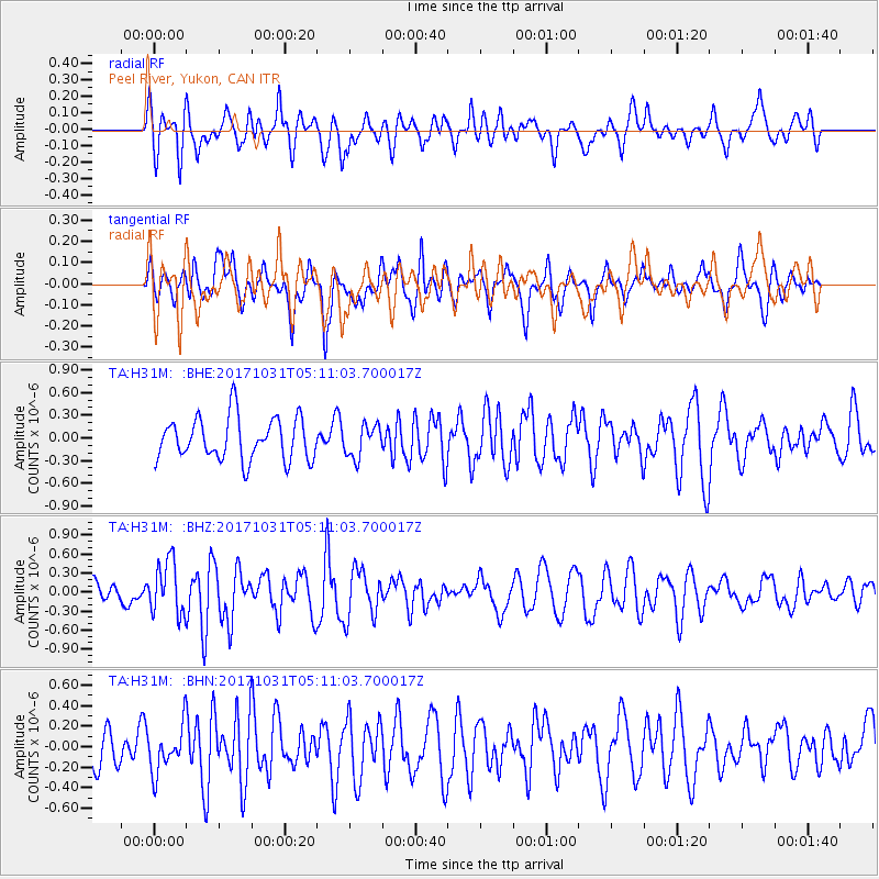
H31M Peel River, Yukon, CAN - Earthquake Result Viewer
*The percent match for this event was below the threshold and hence no stack was calculated.
| Earthquake location: |
Tonga Islands |
| Earthquake latitude/longitude: |
-15.5/-173.3 |
| Earthquake time(UTC): |
2017/10/31 (304) 04:58:58 GMT |
| Earthquake Depth: |
35 km |
| Earthquake Magnitude: |
5.8 mb |
| Earthquake Catalog/Contributor: |
NEIC PDE/us |
|
| Network: |
TA USArray Transportable Network (new EarthScope stations) |
| Station: |
H31M Peel River, Yukon, CAN |
| Lat/Lon: |
65.81 N/134.34 W |
| Elevation: |
642 m |
|
| Distance: |
86.2 deg |
| Az: |
15.059 deg |
| Baz: |
217.422 deg |
| Ray Param: |
$rayparam |
*The percent match for this event was below the threshold and hence was not used in the summary stack. |
|
| Radial Match: |
69.20826 % |
| Radial Bump: |
400 |
| Transverse Match: |
61.043552 % |
| Transverse Bump: |
400 |
| SOD ConfigId: |
13570011 |
| Insert Time: |
2019-04-29 01:34:08.660 +0000 |
| GWidth: |
2.5 |
| Max Bumps: |
400 |
| Tol: |
0.001 |
|
Signal To Noise
| Channel | StoN | STA | LTA |
| TA:H31M: :BHZ:20171031T05:11:03.700017Z | 2.3563647 | 4.1946222E-7 | 1.7801243E-7 |
| TA:H31M: :BHN:20171031T05:11:03.700017Z | 1.0247791 | 2.2416165E-7 | 2.1874145E-7 |
| TA:H31M: :BHE:20171031T05:11:03.700017Z | 0.743675 | 2.040749E-7 | 2.7441408E-7 |
| Arrivals |
| Ps | |
| PpPs | |
| PsPs/PpSs | |


