You are here: Home > Network List > TA - USArray Transportable Network (new EarthScope stations) Stations List
> Station R33M Jennings River, BC, CAN > Earthquake Result Viewer
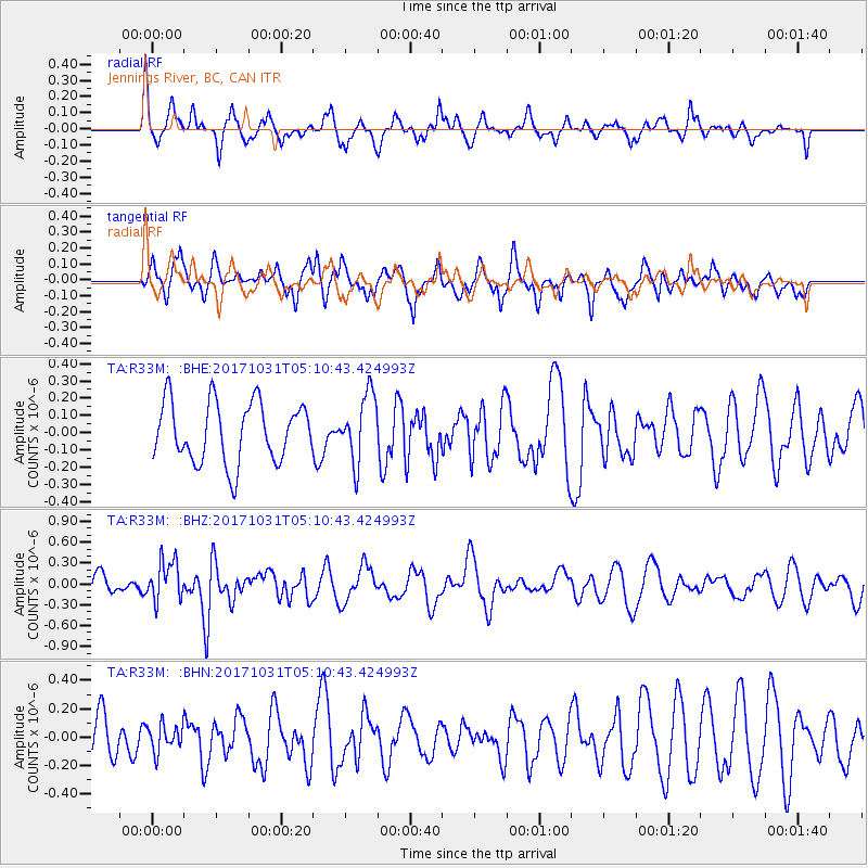
R33M Jennings River, BC, CAN - Earthquake Result Viewer
*The percent match for this event was below the threshold and hence no stack was calculated.
| Earthquake location: |
Tonga Islands |
| Earthquake latitude/longitude: |
-15.5/-173.3 |
| Earthquake time(UTC): |
2017/10/31 (304) 04:58:58 GMT |
| Earthquake Depth: |
35 km |
| Earthquake Magnitude: |
5.8 mb |
| Earthquake Catalog/Contributor: |
NEIC PDE/us |
|
| Network: |
TA USArray Transportable Network (new EarthScope stations) |
| Station: |
R33M Jennings River, BC, CAN |
| Lat/Lon: |
59.39 N/130.97 W |
| Elevation: |
1437 m |
|
| Distance: |
82.2 deg |
| Az: |
20.361 deg |
| Baz: |
220.957 deg |
| Ray Param: |
$rayparam |
*The percent match for this event was below the threshold and hence was not used in the summary stack. |
|
| Radial Match: |
60.30717 % |
| Radial Bump: |
368 |
| Transverse Match: |
48.62073 % |
| Transverse Bump: |
395 |
| SOD ConfigId: |
13570011 |
| Insert Time: |
2019-04-29 01:34:55.086 +0000 |
| GWidth: |
2.5 |
| Max Bumps: |
400 |
| Tol: |
0.001 |
|
Signal To Noise
| Channel | StoN | STA | LTA |
| TA:R33M: :BHZ:20171031T05:10:43.424993Z | 2.3819091 | 2.8927812E-7 | 1.2144801E-7 |
| TA:R33M: :BHN:20171031T05:10:43.424993Z | 0.63452744 | 9.53024E-8 | 1.501943E-7 |
| TA:R33M: :BHE:20171031T05:10:43.424993Z | 1.226678 | 2.1650368E-7 | 1.7649594E-7 |
| Arrivals |
| Ps | |
| PpPs | |
| PsPs/PpSs | |


