You are here: Home > Network List > UW - Pacific Northwest Regional Seismic Network Stations List
> Station LTY Liberty (broad-band) > Earthquake Result Viewer
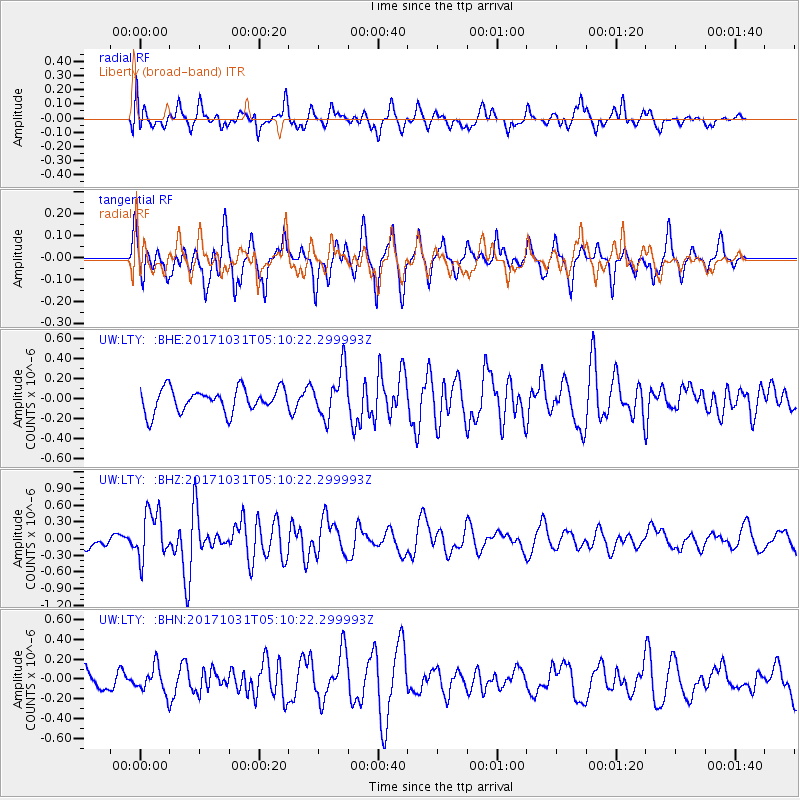
LTY Liberty (broad-band) - Earthquake Result Viewer
*The percent match for this event was below the threshold and hence no stack was calculated.
| Earthquake location: |
Tonga Islands |
| Earthquake latitude/longitude: |
-15.5/-173.3 |
| Earthquake time(UTC): |
2017/10/31 (304) 04:58:58 GMT |
| Earthquake Depth: |
35 km |
| Earthquake Magnitude: |
5.8 mb |
| Earthquake Catalog/Contributor: |
NEIC PDE/us |
|
| Network: |
UW Pacific Northwest Regional Seismic Network |
| Station: |
LTY Liberty (broad-band) |
| Lat/Lon: |
47.26 N/120.66 W |
| Elevation: |
970 m |
|
| Distance: |
78.3 deg |
| Az: |
33.581 deg |
| Baz: |
231.51 deg |
| Ray Param: |
$rayparam |
*The percent match for this event was below the threshold and hence was not used in the summary stack. |
|
| Radial Match: |
52.907047 % |
| Radial Bump: |
400 |
| Transverse Match: |
69.289215 % |
| Transverse Bump: |
400 |
| SOD ConfigId: |
13570011 |
| Insert Time: |
2019-04-29 01:35:53.381 +0000 |
| GWidth: |
2.5 |
| Max Bumps: |
400 |
| Tol: |
0.001 |
|
Signal To Noise
| Channel | StoN | STA | LTA |
| UW:LTY: :BHZ:20171031T05:10:22.299993Z | 3.6716063 | 4.2990976E-7 | 1.1709038E-7 |
| UW:LTY: :BHN:20171031T05:10:22.299993Z | 1.3570836 | 1.404098E-7 | 1.0346437E-7 |
| UW:LTY: :BHE:20171031T05:10:22.299993Z | 2.1427126 | 2.531701E-7 | 1.1815403E-7 |
| Arrivals |
| Ps | |
| PpPs | |
| PsPs/PpSs | |


