You are here: Home > Network List > UW - Pacific Northwest Regional Seismic Network Stations List
> Station UMAT Pilot Rock, OR, USA > Earthquake Result Viewer
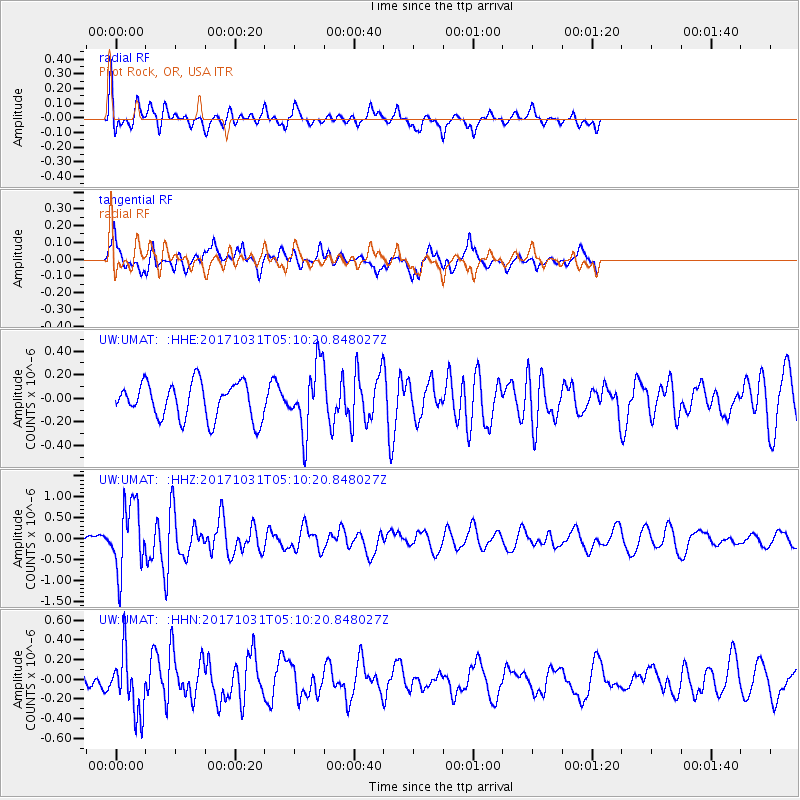
UMAT Pilot Rock, OR, USA - Earthquake Result Viewer
*The percent match for this event was below the threshold and hence no stack was calculated.
| Earthquake location: |
Tonga Islands |
| Earthquake latitude/longitude: |
-15.5/-173.3 |
| Earthquake time(UTC): |
2017/10/31 (304) 04:58:58 GMT |
| Earthquake Depth: |
35 km |
| Earthquake Magnitude: |
5.8 mb |
| Earthquake Catalog/Contributor: |
NEIC PDE/us |
|
| Network: |
UW Pacific Northwest Regional Seismic Network |
| Station: |
UMAT Pilot Rock, OR, USA |
| Lat/Lon: |
45.29 N/118.96 W |
| Elevation: |
1318 m |
|
| Distance: |
78.0 deg |
| Az: |
35.91 deg |
| Baz: |
233.218 deg |
| Ray Param: |
$rayparam |
*The percent match for this event was below the threshold and hence was not used in the summary stack. |
|
| Radial Match: |
53.689453 % |
| Radial Bump: |
400 |
| Transverse Match: |
59.570675 % |
| Transverse Bump: |
380 |
| SOD ConfigId: |
13570011 |
| Insert Time: |
2019-04-29 01:36:05.390 +0000 |
| GWidth: |
2.5 |
| Max Bumps: |
400 |
| Tol: |
0.001 |
|
Signal To Noise
| Channel | StoN | STA | LTA |
| UW:UMAT: :HHZ:20171031T05:10:20.848027Z | 4.9287343 | 8.0782297E-7 | 1.639007E-7 |
| UW:UMAT: :HHN:20171031T05:10:20.848027Z | 2.8201165 | 3.0655542E-7 | 1.08703105E-7 |
| UW:UMAT: :HHE:20171031T05:10:20.848027Z | 1.9084009 | 2.9190676E-7 | 1.5295882E-7 |
| Arrivals |
| Ps | |
| PpPs | |
| PsPs/PpSs | |


