You are here: Home > Network List > TA - USArray Transportable Network (new EarthScope stations) Stations List
> Station N16A Rees Ranch, Coalville, UT, USA > Earthquake Result Viewer
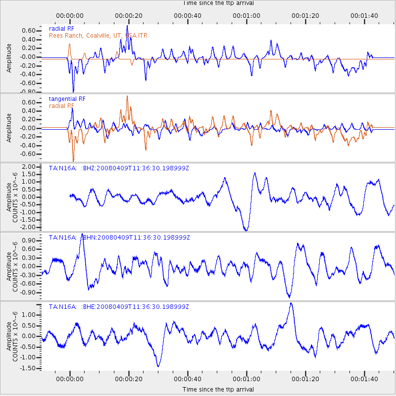
N16A Rees Ranch, Coalville, UT, USA - Earthquake Result Viewer
*The percent match for this event was below the threshold and hence no stack was calculated.
| Earthquake location: |
Loyalty Islands |
| Earthquake latitude/longitude: |
-20.2/168.9 |
| Earthquake time(UTC): |
2008/04/09 (100) 11:23:40 GMT |
| Earthquake Depth: |
35 km |
| Earthquake Magnitude: |
5.7 MB, 6.3 MW, 6.3 MW |
| Earthquake Catalog/Contributor: |
WHDF/NEIC |
|
| Network: |
TA USArray Transportable Network (new EarthScope stations) |
| Station: |
N16A Rees Ranch, Coalville, UT, USA |
| Lat/Lon: |
40.89 N/111.44 W |
| Elevation: |
2028 m |
|
| Distance: |
95.5 deg |
| Az: |
48.53 deg |
| Baz: |
248.178 deg |
| Ray Param: |
$rayparam |
*The percent match for this event was below the threshold and hence was not used in the summary stack. |
|
| Radial Match: |
52.8692 % |
| Radial Bump: |
400 |
| Transverse Match: |
59.42016 % |
| Transverse Bump: |
394 |
| SOD ConfigId: |
2504 |
| Insert Time: |
2010-03-06 05:41:32.415 +0000 |
| GWidth: |
2.5 |
| Max Bumps: |
400 |
| Tol: |
0.001 |
|
Signal To Noise
| Channel | StoN | STA | LTA |
| TA:N16A: :BHN:20080409T11:36:30.198999Z | 3.5282757 | 5.716555E-7 | 1.6202122E-7 |
| TA:N16A: :BHE:20080409T11:36:30.198999Z | 2.068221 | 3.3416634E-7 | 1.6157188E-7 |
| TA:N16A: :BHZ:20080409T11:36:30.198999Z | 1.1414962 | 3.2477467E-7 | 2.8451663E-7 |
| Arrivals |
| Ps | |
| PpPs | |
| PsPs/PpSs | |


