You are here: Home > Network List > TA - USArray Transportable Network (new EarthScope stations) Stations List
> Station C16K Lisburne Hills, AK, USA > Earthquake Result Viewer
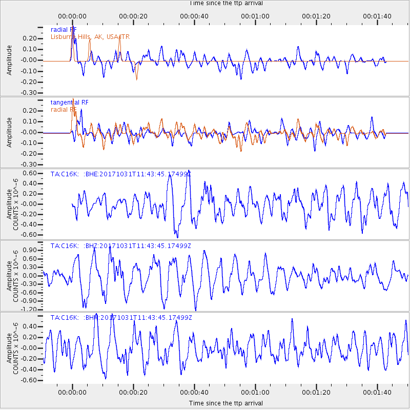
C16K Lisburne Hills, AK, USA - Earthquake Result Viewer
*The percent match for this event was below the threshold and hence no stack was calculated.
| Earthquake location: |
Seram, Indonesia |
| Earthquake latitude/longitude: |
-3.8/127.7 |
| Earthquake time(UTC): |
2017/10/31 (304) 11:31:42 GMT |
| Earthquake Depth: |
27 km |
| Earthquake Magnitude: |
5.9 Mww |
| Earthquake Catalog/Contributor: |
NEIC PDE/us |
|
| Network: |
TA USArray Transportable Network (new EarthScope stations) |
| Station: |
C16K Lisburne Hills, AK, USA |
| Lat/Lon: |
68.27 N/165.34 W |
| Elevation: |
102 m |
|
| Distance: |
85.2 deg |
| Az: |
20.107 deg |
| Baz: |
247.126 deg |
| Ray Param: |
$rayparam |
*The percent match for this event was below the threshold and hence was not used in the summary stack. |
|
| Radial Match: |
71.63233 % |
| Radial Bump: |
400 |
| Transverse Match: |
58.617657 % |
| Transverse Bump: |
400 |
| SOD ConfigId: |
13570011 |
| Insert Time: |
2019-04-29 01:39:15.113 +0000 |
| GWidth: |
2.5 |
| Max Bumps: |
400 |
| Tol: |
0.001 |
|
Signal To Noise
| Channel | StoN | STA | LTA |
| TA:C16K: :BHZ:20171031T11:43:45.17499Z | 4.0492635 | 6.458443E-7 | 1.5949675E-7 |
| TA:C16K: :BHN:20171031T11:43:45.17499Z | 1.31689 | 2.2007937E-7 | 1.6712053E-7 |
| TA:C16K: :BHE:20171031T11:43:45.17499Z | 2.7437942 | 3.9250045E-7 | 1.4305024E-7 |
| Arrivals |
| Ps | |
| PpPs | |
| PsPs/PpSs | |


