You are here: Home > Network List > TA - USArray Transportable Network (new EarthScope stations) Stations List
> Station G21K Allakaket, AK, USA > Earthquake Result Viewer
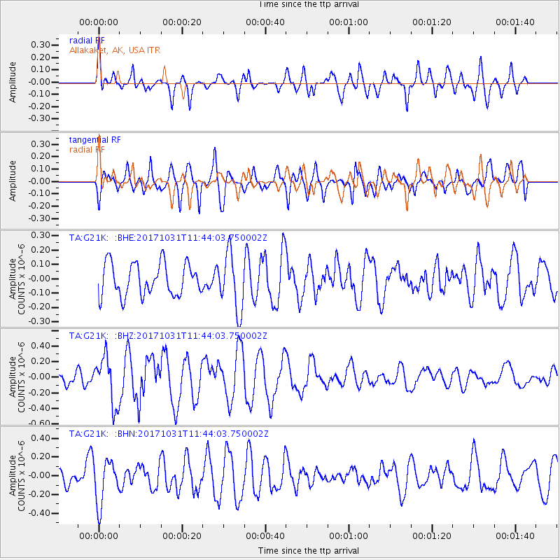
G21K Allakaket, AK, USA - Earthquake Result Viewer
*The percent match for this event was below the threshold and hence no stack was calculated.
| Earthquake location: |
Seram, Indonesia |
| Earthquake latitude/longitude: |
-3.8/127.7 |
| Earthquake time(UTC): |
2017/10/31 (304) 11:31:42 GMT |
| Earthquake Depth: |
27 km |
| Earthquake Magnitude: |
5.9 Mww |
| Earthquake Catalog/Contributor: |
NEIC PDE/us |
|
| Network: |
TA USArray Transportable Network (new EarthScope stations) |
| Station: |
G21K Allakaket, AK, USA |
| Lat/Lon: |
66.52 N/153.51 W |
| Elevation: |
446 m |
|
| Distance: |
89.0 deg |
| Az: |
23.15 deg |
| Baz: |
258.206 deg |
| Ray Param: |
$rayparam |
*The percent match for this event was below the threshold and hence was not used in the summary stack. |
|
| Radial Match: |
59.553467 % |
| Radial Bump: |
400 |
| Transverse Match: |
62.24743 % |
| Transverse Bump: |
400 |
| SOD ConfigId: |
13570011 |
| Insert Time: |
2019-04-29 01:39:34.956 +0000 |
| GWidth: |
2.5 |
| Max Bumps: |
400 |
| Tol: |
0.001 |
|
Signal To Noise
| Channel | StoN | STA | LTA |
| TA:G21K: :BHZ:20171031T11:44:03.750002Z | 2.434513 | 3.1665684E-7 | 1.3006988E-7 |
| TA:G21K: :BHN:20171031T11:44:03.750002Z | 1.4477865 | 2.3788773E-7 | 1.6431133E-7 |
| TA:G21K: :BHE:20171031T11:44:03.750002Z | 1.8143704 | 2.0321913E-7 | 1.1200532E-7 |
| Arrivals |
| Ps | |
| PpPs | |
| PsPs/PpSs | |


