You are here: Home > Network List > TA - USArray Transportable Network (new EarthScope stations) Stations List
> Station R32K Eaglecrest, AK, USA > Earthquake Result Viewer
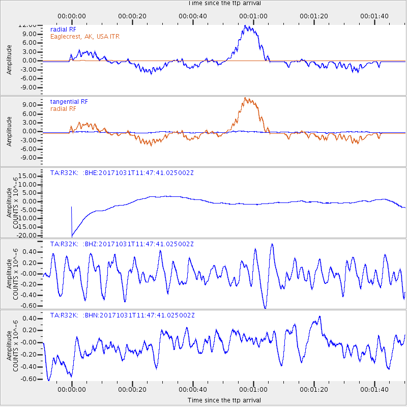
R32K Eaglecrest, AK, USA - Earthquake Result Viewer
*The percent match for this event was below the threshold and hence no stack was calculated.
| Earthquake location: |
Seram, Indonesia |
| Earthquake latitude/longitude: |
-3.8/127.7 |
| Earthquake time(UTC): |
2017/10/31 (304) 11:34:44 GMT |
| Earthquake Depth: |
48 km |
| Earthquake Magnitude: |
5.7 mb |
| Earthquake Catalog/Contributor: |
NEIC PDE/us |
|
| Network: |
TA USArray Transportable Network (new EarthScope stations) |
| Station: |
R32K Eaglecrest, AK, USA |
| Lat/Lon: |
58.27 N/134.52 W |
| Elevation: |
386 m |
|
| Distance: |
97.3 deg |
| Az: |
31.859 deg |
| Baz: |
274.641 deg |
| Ray Param: |
$rayparam |
*The percent match for this event was below the threshold and hence was not used in the summary stack. |
|
| Radial Match: |
35.323704 % |
| Radial Bump: |
400 |
| Transverse Match: |
26.401878 % |
| Transverse Bump: |
400 |
| SOD ConfigId: |
13570011 |
| Insert Time: |
2019-04-29 01:42:50.975 +0000 |
| GWidth: |
2.5 |
| Max Bumps: |
400 |
| Tol: |
0.001 |
|
Signal To Noise
| Channel | StoN | STA | LTA |
| TA:R32K: :BHZ:20171031T11:47:41.025002Z | 1.1461293 | 2.1505292E-7 | 1.876341E-7 |
| TA:R32K: :BHN:20171031T11:47:41.025002Z | 0.9702288 | 8.504631E-7 | 8.765593E-7 |
| TA:R32K: :BHE:20171031T11:47:41.025002Z | 1.449346 | 7.922962E-6 | 5.4665775E-6 |
| Arrivals |
| Ps | |
| PpPs | |
| PsPs/PpSs | |


