You are here: Home > Network List > TA - USArray Transportable Network (new EarthScope stations) Stations List
> Station B18K Kokolik River, AK, USA > Earthquake Result Viewer
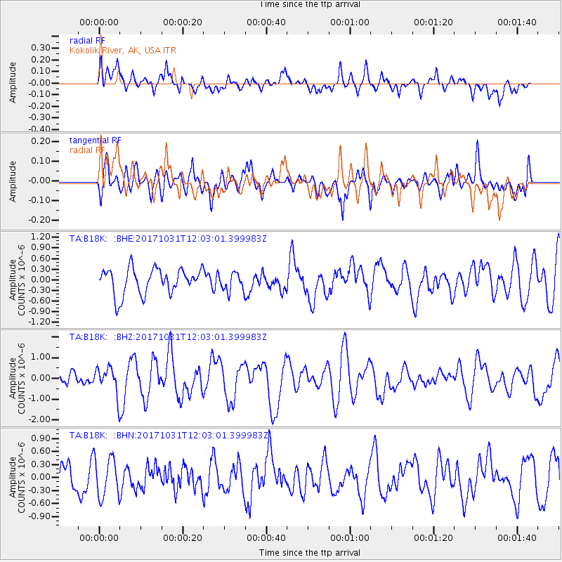
B18K Kokolik River, AK, USA - Earthquake Result Viewer
*The percent match for this event was below the threshold and hence no stack was calculated.
| Earthquake location: |
Seram, Indonesia |
| Earthquake latitude/longitude: |
-3.7/127.8 |
| Earthquake time(UTC): |
2017/10/31 (304) 11:50:51 GMT |
| Earthquake Depth: |
32 km |
| Earthquake Magnitude: |
6.3 Mww |
| Earthquake Catalog/Contributor: |
NEIC PDE/us |
|
| Network: |
TA USArray Transportable Network (new EarthScope stations) |
| Station: |
B18K Kokolik River, AK, USA |
| Lat/Lon: |
69.36 N/161.80 W |
| Elevation: |
222 m |
|
| Distance: |
86.6 deg |
| Az: |
19.543 deg |
| Baz: |
250.33 deg |
| Ray Param: |
$rayparam |
*The percent match for this event was below the threshold and hence was not used in the summary stack. |
|
| Radial Match: |
65.90911 % |
| Radial Bump: |
400 |
| Transverse Match: |
55.049267 % |
| Transverse Bump: |
400 |
| SOD ConfigId: |
13570011 |
| Insert Time: |
2019-04-29 01:46:29.975 +0000 |
| GWidth: |
2.5 |
| Max Bumps: |
400 |
| Tol: |
0.001 |
|
Signal To Noise
| Channel | StoN | STA | LTA |
| TA:B18K: :BHZ:20171031T12:03:01.399983Z | 2.514221 | 6.970122E-7 | 2.7722788E-7 |
| TA:B18K: :BHN:20171031T12:03:01.399983Z | 1.8168952 | 4.382098E-7 | 2.4118606E-7 |
| TA:B18K: :BHE:20171031T12:03:01.399983Z | 0.6628448 | 2.394783E-7 | 3.612887E-7 |
| Arrivals |
| Ps | |
| PpPs | |
| PsPs/PpSs | |


