You are here: Home > Network List > TA - USArray Transportable Network (new EarthScope stations) Stations List
> Station F26K Sheenjek River, AK, USA > Earthquake Result Viewer
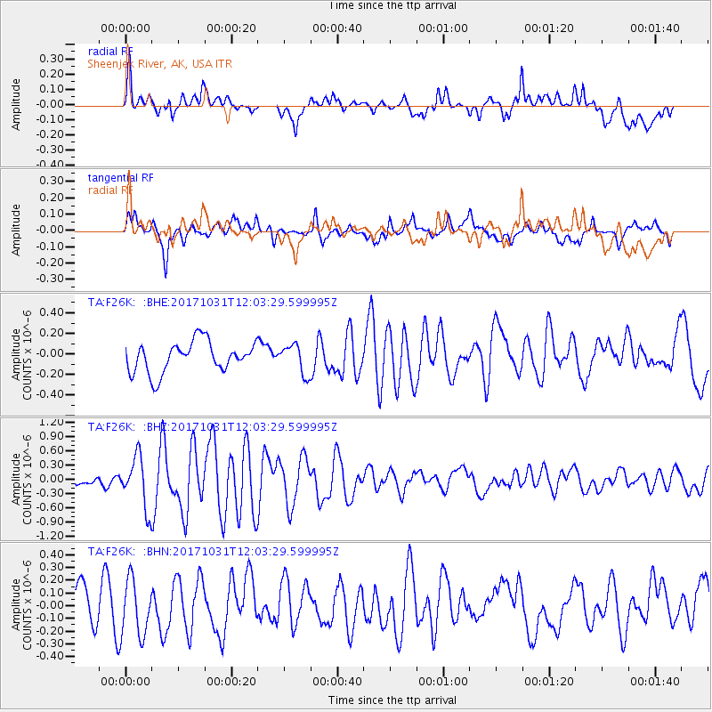
F26K Sheenjek River, AK, USA - Earthquake Result Viewer
*The percent match for this event was below the threshold and hence no stack was calculated.
| Earthquake location: |
Seram, Indonesia |
| Earthquake latitude/longitude: |
-3.7/127.8 |
| Earthquake time(UTC): |
2017/10/31 (304) 11:50:51 GMT |
| Earthquake Depth: |
32 km |
| Earthquake Magnitude: |
6.3 Mww |
| Earthquake Catalog/Contributor: |
NEIC PDE/us |
|
| Network: |
TA USArray Transportable Network (new EarthScope stations) |
| Station: |
F26K Sheenjek River, AK, USA |
| Lat/Lon: |
67.69 N/144.15 W |
| Elevation: |
683 m |
|
| Distance: |
92.6 deg |
| Az: |
22.452 deg |
| Baz: |
266.784 deg |
| Ray Param: |
$rayparam |
*The percent match for this event was below the threshold and hence was not used in the summary stack. |
|
| Radial Match: |
78.0428 % |
| Radial Bump: |
400 |
| Transverse Match: |
64.63738 % |
| Transverse Bump: |
400 |
| SOD ConfigId: |
13570011 |
| Insert Time: |
2019-04-29 01:47:01.164 +0000 |
| GWidth: |
2.5 |
| Max Bumps: |
400 |
| Tol: |
0.001 |
|
Signal To Noise
| Channel | StoN | STA | LTA |
| TA:F26K: :BHZ:20171031T12:03:29.599995Z | 5.3432503 | 5.5650315E-7 | 1.04150686E-7 |
| TA:F26K: :BHN:20171031T12:03:29.599995Z | 1.4404348 | 2.1585241E-7 | 1.4985226E-7 |
| TA:F26K: :BHE:20171031T12:03:29.599995Z | 0.8930438 | 1.3205685E-7 | 1.4787277E-7 |
| Arrivals |
| Ps | |
| PpPs | |
| PsPs/PpSs | |


