You are here: Home > Network List > TA - USArray Transportable Network (new EarthScope stations) Stations List
> Station L19K White Mountain, AK, USA > Earthquake Result Viewer
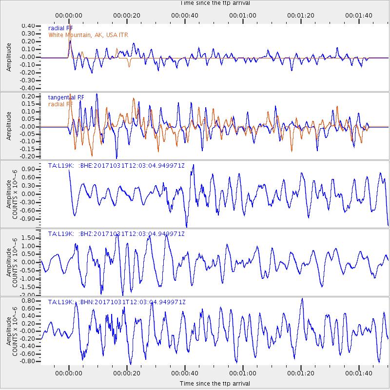
L19K White Mountain, AK, USA - Earthquake Result Viewer
*The percent match for this event was below the threshold and hence no stack was calculated.
| Earthquake location: |
Seram, Indonesia |
| Earthquake latitude/longitude: |
-3.7/127.8 |
| Earthquake time(UTC): |
2017/10/31 (304) 11:50:51 GMT |
| Earthquake Depth: |
32 km |
| Earthquake Magnitude: |
6.3 Mww |
| Earthquake Catalog/Contributor: |
NEIC PDE/us |
|
| Network: |
TA USArray Transportable Network (new EarthScope stations) |
| Station: |
L19K White Mountain, AK, USA |
| Lat/Lon: |
62.18 N/154.85 W |
| Elevation: |
650 m |
|
| Distance: |
87.4 deg |
| Az: |
27.27 deg |
| Baz: |
257.078 deg |
| Ray Param: |
$rayparam |
*The percent match for this event was below the threshold and hence was not used in the summary stack. |
|
| Radial Match: |
61.89018 % |
| Radial Bump: |
400 |
| Transverse Match: |
57.630802 % |
| Transverse Bump: |
393 |
| SOD ConfigId: |
13570011 |
| Insert Time: |
2019-04-29 01:47:45.298 +0000 |
| GWidth: |
2.5 |
| Max Bumps: |
400 |
| Tol: |
0.001 |
|
Signal To Noise
| Channel | StoN | STA | LTA |
| TA:L19K: :BHZ:20171031T12:03:04.949971Z | 3.297422 | 7.033826E-7 | 2.133129E-7 |
| TA:L19K: :BHN:20171031T12:03:04.949971Z | 2.0892167 | 4.2069783E-7 | 2.013663E-7 |
| TA:L19K: :BHE:20171031T12:03:04.949971Z | 0.7287503 | 2.0637431E-7 | 2.8318934E-7 |
| Arrivals |
| Ps | |
| PpPs | |
| PsPs/PpSs | |


