Q15A Fillmore, UT, USA - Earthquake Result Viewer
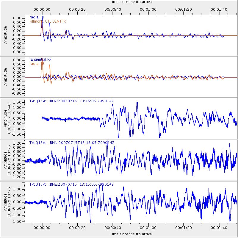
Earthquake location: Fox Islands, Aleutian Islands
Earthquake latitude/longitude: 52.5/-168.0
Earthquake time(UTC): 2007/07/15 (196) 13:08:00 GMT
Earthquake Depth: 10 km
Earthquake Magnitude: 5.8 MB, 5.9 MS, 6.1 MW, 6.0 MW
Earthquake Catalog/Contributor: WHDF/NEIC
Network: TA USArray Transportable Network (new EarthScope stations)
Station: Q15A Fillmore, UT, USA
Lat/Lon: 39.00 N/112.38 W
Elevation: 1477 m
Distance: 40.1 deg
Az: 86.828 deg
Baz: 308.397 deg
Ray Param: 0.0745732
Estimated Moho Depth: 33.25 km
Estimated Crust Vp/Vs: 1.75
Assumed Crust Vp: 6.276 km/s
Estimated Crust Vs: 3.596 km/s
Estimated Crust Poisson's Ratio: 0.26
Radial Match: 92.76417 %
Radial Bump: 400
Transverse Match: 83.6122 %
Transverse Bump: 400
SOD ConfigId: 2564
Insert Time: 2010-03-06 05:44:46.431 +0000
GWidth: 2.5
Max Bumps: 400
Tol: 0.001

Signal To Noise

ChannelStoNSTALTA
TA:Q15A: :BHN:20070715T13:15:05.799014Z1.71933951.3597266E-77.908424E-8
TA:Q15A: :BHE:20070715T13:15:05.799014Z2.03906131.5501072E-77.6020626E-8
TA:Q15A: :BHZ:20070715T13:15:05.799014Z4.1599832.82075E-76.780676E-8
Arrivals
Ps4.2 SECOND
PpPs14 SECOND
PsPs/PpSs18 SECOND