
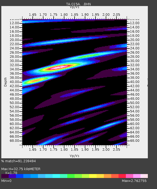
Q15A Fillmore, UT, USA - Earthquake Result Viewer
| ||||||||||||||||||
| ||||||||||||||||||
| ||||||||||||||||||
|
Signal To Noise
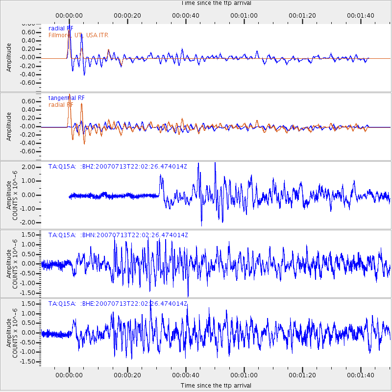
| Channel | StoN | STA | LTA |
| TA:Q15A: :BHN:20070713T22:02:26.474014Z | 2.2518027 | 3.0919344E-7 | 1.373093E-7 |
| TA:Q15A: :BHE:20070713T22:02:26.474014Z | 2.3054137 | 3.7810548E-7 | 1.6400764E-7 |
| TA:Q15A: :BHZ:20070713T22:02:26.474014Z | 6.5274367 | 6.30272E-7 | 9.655735E-8 |
| Arrivals | |
| Ps | 4.3 SECOND |
| PpPs | 14 SECOND |
| PsPs/PpSs | 18 SECOND |

