You are here: Home > Network List > TA - USArray Transportable Network (new EarthScope stations) Stations List
> Station Q15A Fillmore, UT, USA > Earthquake Result Viewer
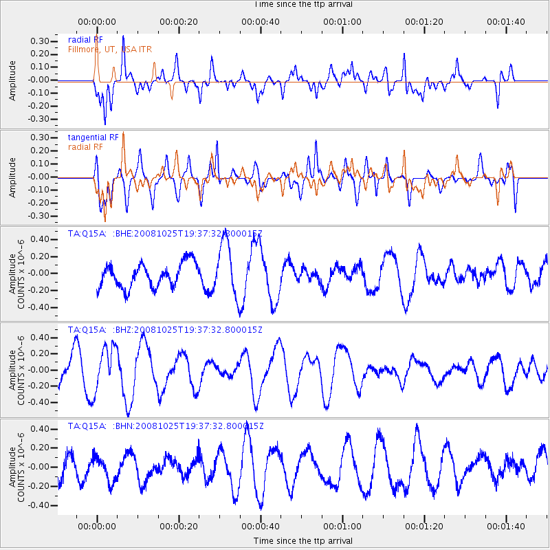
Q15A Fillmore, UT, USA - Earthquake Result Viewer
*The percent match for this event was below the threshold and hence no stack was calculated.
| Earthquake location: |
Vanuatu Islands |
| Earthquake latitude/longitude: |
-17.2/167.3 |
| Earthquake time(UTC): |
2008/10/25 (299) 19:24:50 GMT |
| Earthquake Depth: |
23 km |
| Earthquake Magnitude: |
5.7 MB, 5.3 MS, 5.7 MW, 5.7 MW |
| Earthquake Catalog/Contributor: |
WHDF/NEIC |
|
| Network: |
TA USArray Transportable Network (new EarthScope stations) |
| Station: |
Q15A Fillmore, UT, USA |
| Lat/Lon: |
39.00 N/112.38 W |
| Elevation: |
1477 m |
|
| Distance: |
93.4 deg |
| Az: |
50.318 deg |
| Baz: |
250.719 deg |
| Ray Param: |
$rayparam |
*The percent match for this event was below the threshold and hence was not used in the summary stack. |
|
| Radial Match: |
68.95933 % |
| Radial Bump: |
400 |
| Transverse Match: |
77.83863 % |
| Transverse Bump: |
400 |
| SOD ConfigId: |
2560 |
| Insert Time: |
2010-03-06 05:45:08.571 +0000 |
| GWidth: |
2.5 |
| Max Bumps: |
400 |
| Tol: |
0.001 |
|
Signal To Noise
| Channel | StoN | STA | LTA |
| TA:Q15A: :BHZ:20081025T19:37:32.800015Z | 1.4624587 | 2.630212E-7 | 1.7984864E-7 |
| TA:Q15A: :BHN:20081025T19:37:32.800015Z | 0.7323915 | 1.2958026E-7 | 1.7692759E-7 |
| TA:Q15A: :BHE:20081025T19:37:32.800015Z | 2.3545861 | 3.3293404E-7 | 1.4139812E-7 |
| Arrivals |
| Ps | |
| PpPs | |
| PsPs/PpSs | |


