You are here: Home > Network List > TA - USArray Transportable Network (new EarthScope stations) Stations List
> Station Q15A Fillmore, UT, USA > Earthquake Result Viewer
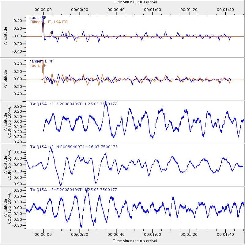
Q15A Fillmore, UT, USA - Earthquake Result Viewer
*The percent match for this event was below the threshold and hence no stack was calculated.
| Earthquake location: |
Loyalty Islands |
| Earthquake latitude/longitude: |
-20.2/168.9 |
| Earthquake time(UTC): |
2008/04/09 (100) 11:13:17 GMT |
| Earthquake Depth: |
13 km |
| Earthquake Magnitude: |
5.6 MB, 6.3 MS, 6.4 MW, 6.3 MW |
| Earthquake Catalog/Contributor: |
WHDF/NEIC |
|
| Network: |
TA USArray Transportable Network (new EarthScope stations) |
| Station: |
Q15A Fillmore, UT, USA |
| Lat/Lon: |
39.00 N/112.38 W |
| Elevation: |
1477 m |
|
| Distance: |
94.1 deg |
| Az: |
50.02 deg |
| Baz: |
247.485 deg |
| Ray Param: |
$rayparam |
*The percent match for this event was below the threshold and hence was not used in the summary stack. |
|
| Radial Match: |
75.917755 % |
| Radial Bump: |
400 |
| Transverse Match: |
79.508705 % |
| Transverse Bump: |
400 |
| SOD ConfigId: |
2504 |
| Insert Time: |
2010-03-06 05:45:23.861 +0000 |
| GWidth: |
2.5 |
| Max Bumps: |
400 |
| Tol: |
0.001 |
|
Signal To Noise
| Channel | StoN | STA | LTA |
| TA:Q15A: :BHN:20080409T11:26:03.750017Z | 2.6656375 | 4.185547E-7 | 1.570186E-7 |
| TA:Q15A: :BHE:20080409T11:26:03.750017Z | 1.1076202 | 9.149814E-8 | 8.2607855E-8 |
| TA:Q15A: :BHZ:20080409T11:26:03.750017Z | 2.0540493 | 2.0438095E-7 | 9.9501484E-8 |
| Arrivals |
| Ps | |
| PpPs | |
| PsPs/PpSs | |


