You are here: Home > Network List > TA - USArray Transportable Network (new EarthScope stations) Stations List
> Station H16K Elim, AK, USA > Earthquake Result Viewer
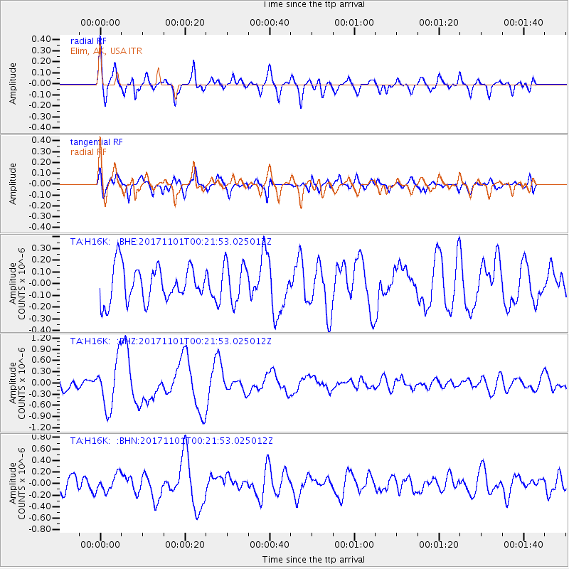
H16K Elim, AK, USA - Earthquake Result Viewer
*The percent match for this event was below the threshold and hence no stack was calculated.
| Earthquake location: |
Loyalty Islands |
| Earthquake latitude/longitude: |
-21.7/168.9 |
| Earthquake time(UTC): |
2017/11/01 (305) 00:09:29 GMT |
| Earthquake Depth: |
10 km |
| Earthquake Magnitude: |
6.1 Mww |
| Earthquake Catalog/Contributor: |
NEIC PDE/us |
|
| Network: |
TA USArray Transportable Network (new EarthScope stations) |
| Station: |
H16K Elim, AK, USA |
| Lat/Lon: |
64.64 N/162.24 W |
| Elevation: |
216 m |
|
| Distance: |
88.9 deg |
| Az: |
11.987 deg |
| Baz: |
206.638 deg |
| Ray Param: |
$rayparam |
*The percent match for this event was below the threshold and hence was not used in the summary stack. |
|
| Radial Match: |
77.036674 % |
| Radial Bump: |
400 |
| Transverse Match: |
57.186367 % |
| Transverse Bump: |
400 |
| SOD ConfigId: |
13570011 |
| Insert Time: |
2019-04-29 01:57:05.549 +0000 |
| GWidth: |
2.5 |
| Max Bumps: |
400 |
| Tol: |
0.001 |
|
Signal To Noise
| Channel | StoN | STA | LTA |
| TA:H16K: :BHZ:20171101T00:21:53.025012Z | 5.3054266 | 6.693193E-7 | 1.2615749E-7 |
| TA:H16K: :BHN:20171101T00:21:53.025012Z | 1.1199704 | 1.4447288E-7 | 1.2899704E-7 |
| TA:H16K: :BHE:20171101T00:21:53.025012Z | 1.1521093 | 1.7058186E-7 | 1.4806048E-7 |
| Arrivals |
| Ps | |
| PpPs | |
| PsPs/PpSs | |


