You are here: Home > Network List > TA - USArray Transportable Network (new EarthScope stations) Stations List
> Station P17K Kvichak River, AK, USA > Earthquake Result Viewer
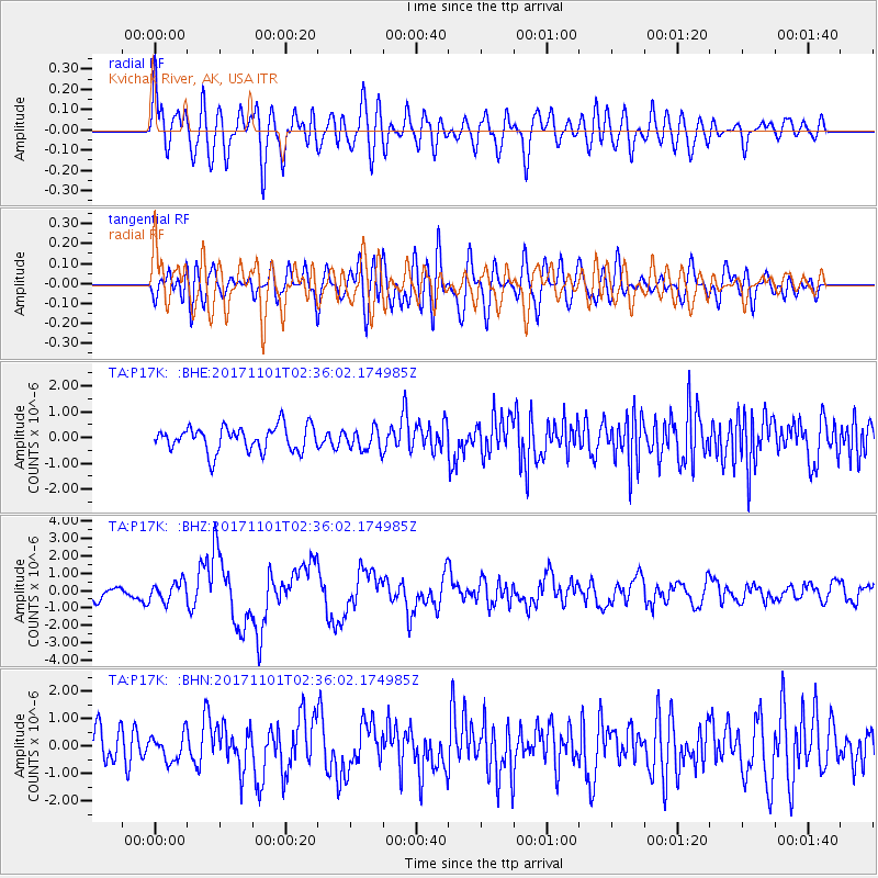
P17K Kvichak River, AK, USA - Earthquake Result Viewer
*The percent match for this event was below the threshold and hence no stack was calculated.
| Earthquake location: |
Loyalty Islands |
| Earthquake latitude/longitude: |
-21.6/168.9 |
| Earthquake time(UTC): |
2017/11/01 (305) 02:23:56 GMT |
| Earthquake Depth: |
10 km |
| Earthquake Magnitude: |
6.6 mww |
| Earthquake Catalog/Contributor: |
NEIC PDE/us |
|
| Network: |
TA USArray Transportable Network (new EarthScope stations) |
| Station: |
P17K Kvichak River, AK, USA |
| Lat/Lon: |
59.20 N/156.44 W |
| Elevation: |
91 m |
|
| Distance: |
85.4 deg |
| Az: |
17.082 deg |
| Baz: |
212.076 deg |
| Ray Param: |
$rayparam |
*The percent match for this event was below the threshold and hence was not used in the summary stack. |
|
| Radial Match: |
73.26855 % |
| Radial Bump: |
400 |
| Transverse Match: |
62.668068 % |
| Transverse Bump: |
400 |
| SOD ConfigId: |
13570011 |
| Insert Time: |
2019-04-29 02:03:22.219 +0000 |
| GWidth: |
2.5 |
| Max Bumps: |
400 |
| Tol: |
0.001 |
|
Signal To Noise
| Channel | StoN | STA | LTA |
| TA:P17K: :BHZ:20171101T02:36:02.174985Z | 1.7977008 | 5.45856E-7 | 3.0364117E-7 |
| TA:P17K: :BHN:20171101T02:36:02.174985Z | 1.0991118 | 4.7488604E-7 | 4.3206347E-7 |
| TA:P17K: :BHE:20171101T02:36:02.174985Z | 0.88199824 | 4.2610486E-7 | 4.8311307E-7 |
| Arrivals |
| Ps | |
| PpPs | |
| PsPs/PpSs | |


