You are here: Home > Network List > AV - Alaska Volcano Observatory Stations List
> Station MAPS Pakushin Southeast, Makushin Volcano, Alaska > Earthquake Result Viewer
MAPS Pakushin Southeast, Makushin Volcano, Alaska - Earthquake Result Viewer
*The percent match for this event was below the threshold and hence no stack was calculated.
| Earthquake location: |
Loyalty Islands |
| Earthquake latitude/longitude: |
-21.8/168.9 |
| Earthquake time(UTC): |
2017/11/01 (305) 05:09:00 GMT |
| Earthquake Depth: |
10 km |
| Earthquake Magnitude: |
6.0 Mww |
| Earthquake Catalog/Contributor: |
NEIC PDE/us |
|
| Network: |
AV Alaska Volcano Observatory |
| Station: |
MAPS Pakushin Southeast, Makushin Volcano, Alaska |
| Lat/Lon: |
53.81 N/166.94 W |
| Elevation: |
333 m |
|
| Distance: |
78.1 deg |
| Az: |
14.351 deg |
| Baz: |
202.856 deg |
| Ray Param: |
$rayparam |
*The percent match for this event was below the threshold and hence was not used in the summary stack. |
|
| Radial Match: |
56.802567 % |
| Radial Bump: |
400 |
| Transverse Match: |
55.471443 % |
| Transverse Bump: |
383 |
| SOD ConfigId: |
13570011 |
| Insert Time: |
2019-04-29 02:05:56.246 +0000 |
| GWidth: |
2.5 |
| Max Bumps: |
400 |
| Tol: |
0.001 |
|
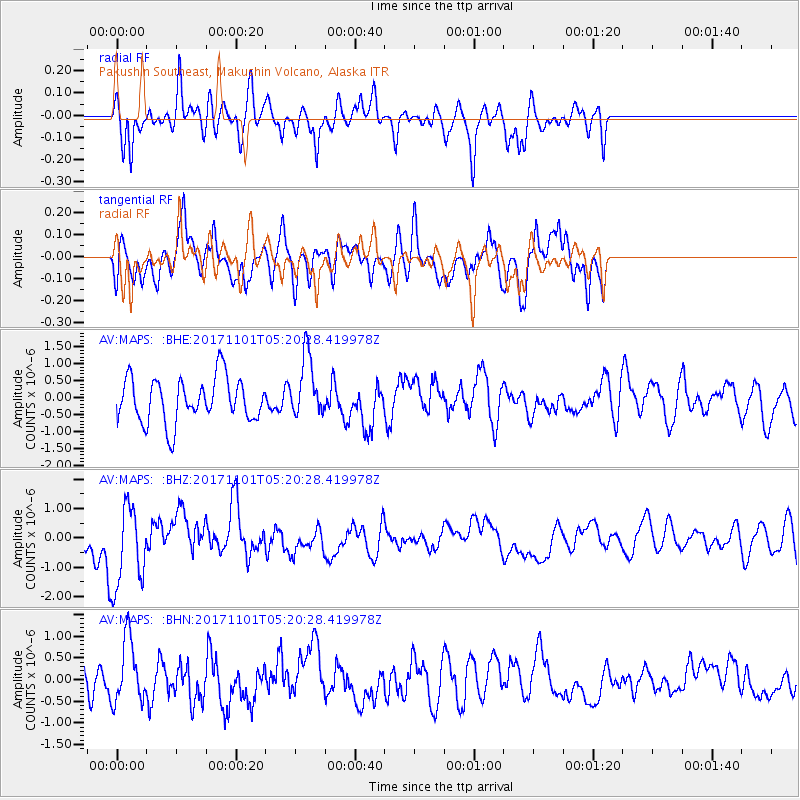
Signal To Noise
| Channel | StoN | STA | LTA |
| AV:MAPS: :BHZ:20171101T05:20:28.419978Z | 3.8136208 | 1.4038329E-6 | 3.6811025E-7 |
| AV:MAPS: :BHN:20171101T05:20:28.419978Z | 1.7490606 | 7.2633713E-7 | 4.152727E-7 |
| AV:MAPS: :BHE:20171101T05:20:28.419978Z | 1.3737254 | 9.059817E-7 | 6.595071E-7 |
| Arrivals |
| Ps | |
| PpPs | |
| PsPs/PpSs | |


