You are here: Home > Network List > TA - USArray Transportable Network (new EarthScope stations) Stations List
> Station J26L Joseph Creek, AK, USA > Earthquake Result Viewer
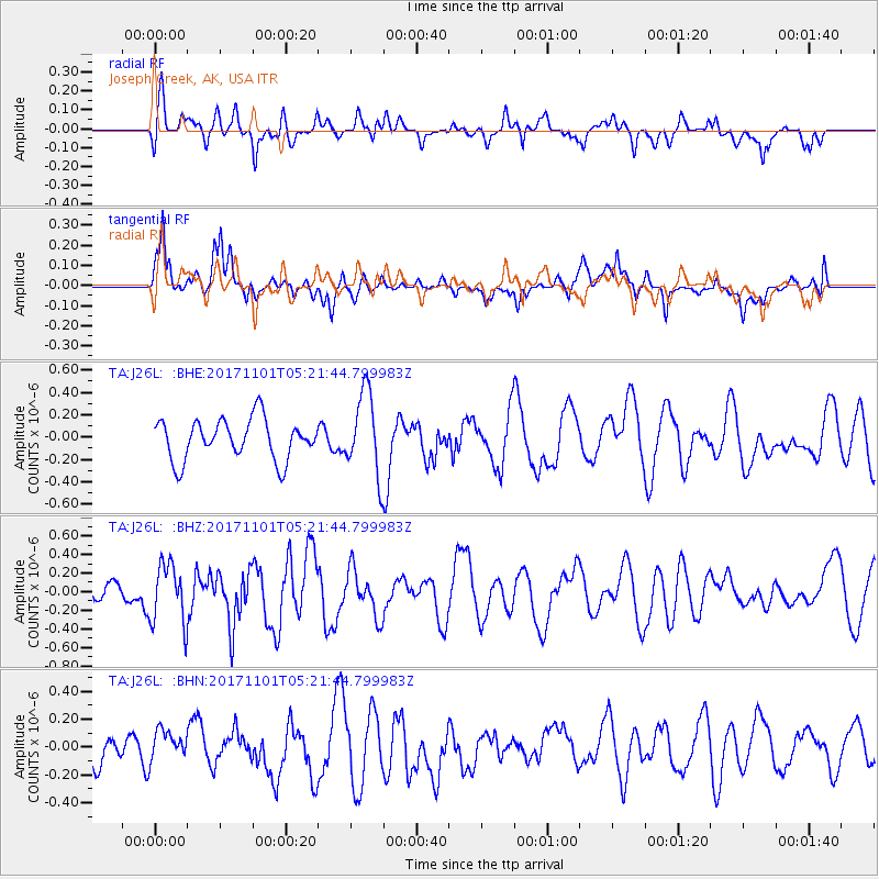
J26L Joseph Creek, AK, USA - Earthquake Result Viewer
*The percent match for this event was below the threshold and hence no stack was calculated.
| Earthquake location: |
Loyalty Islands |
| Earthquake latitude/longitude: |
-21.8/168.9 |
| Earthquake time(UTC): |
2017/11/01 (305) 05:09:00 GMT |
| Earthquake Depth: |
10 km |
| Earthquake Magnitude: |
6.0 Mww |
| Earthquake Catalog/Contributor: |
NEIC PDE/us |
|
| Network: |
TA USArray Transportable Network (new EarthScope stations) |
| Station: |
J26L Joseph Creek, AK, USA |
| Lat/Lon: |
64.50 N/143.56 W |
| Elevation: |
1144 m |
|
| Distance: |
93.5 deg |
| Az: |
18.652 deg |
| Baz: |
223.369 deg |
| Ray Param: |
$rayparam |
*The percent match for this event was below the threshold and hence was not used in the summary stack. |
|
| Radial Match: |
55.319145 % |
| Radial Bump: |
400 |
| Transverse Match: |
55.131416 % |
| Transverse Bump: |
400 |
| SOD ConfigId: |
13570011 |
| Insert Time: |
2019-04-29 02:09:58.223 +0000 |
| GWidth: |
2.5 |
| Max Bumps: |
400 |
| Tol: |
0.001 |
|
Signal To Noise
| Channel | StoN | STA | LTA |
| TA:J26L: :BHZ:20171101T05:21:44.799983Z | 2.1725445 | 3.2247536E-7 | 1.484321E-7 |
| TA:J26L: :BHN:20171101T05:21:44.799983Z | 0.90064335 | 1.0797079E-7 | 1.1988185E-7 |
| TA:J26L: :BHE:20171101T05:21:44.799983Z | 2.0311553 | 3.662412E-7 | 1.8031176E-7 |
| Arrivals |
| Ps | |
| PpPs | |
| PsPs/PpSs | |


