You are here: Home > Network List > TA - USArray Transportable Network (new EarthScope stations) Stations List
> Station L15K Ungalak Mountain, AK, USA > Earthquake Result Viewer
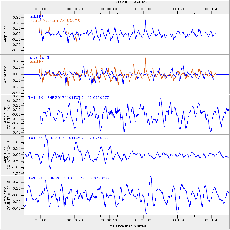
L15K Ungalak Mountain, AK, USA - Earthquake Result Viewer
*The percent match for this event was below the threshold and hence no stack was calculated.
| Earthquake location: |
Loyalty Islands |
| Earthquake latitude/longitude: |
-21.8/168.9 |
| Earthquake time(UTC): |
2017/11/01 (305) 05:09:00 GMT |
| Earthquake Depth: |
10 km |
| Earthquake Magnitude: |
6.0 Mww |
| Earthquake Catalog/Contributor: |
NEIC PDE/us |
|
| Network: |
TA USArray Transportable Network (new EarthScope stations) |
| Station: |
L15K Ungalak Mountain, AK, USA |
| Lat/Lon: |
61.68 N/161.49 W |
| Elevation: |
219 m |
|
| Distance: |
86.5 deg |
| Az: |
13.648 deg |
| Baz: |
207.377 deg |
| Ray Param: |
$rayparam |
*The percent match for this event was below the threshold and hence was not used in the summary stack. |
|
| Radial Match: |
64.759674 % |
| Radial Bump: |
400 |
| Transverse Match: |
68.4463 % |
| Transverse Bump: |
400 |
| SOD ConfigId: |
13570011 |
| Insert Time: |
2019-04-29 02:10:05.122 +0000 |
| GWidth: |
2.5 |
| Max Bumps: |
400 |
| Tol: |
0.001 |
|
Signal To Noise
| Channel | StoN | STA | LTA |
| TA:L15K: :BHZ:20171101T05:21:12.075007Z | 5.1576385 | 8.098902E-7 | 1.5702733E-7 |
| TA:L15K: :BHN:20171101T05:21:12.075007Z | 1.077311 | 1.8666793E-7 | 1.7327207E-7 |
| TA:L15K: :BHE:20171101T05:21:12.075007Z | 0.7191642 | 1.02072E-7 | 1.4193144E-7 |
| Arrivals |
| Ps | |
| PpPs | |
| PsPs/PpSs | |


