You are here: Home > Network List > TA - USArray Transportable Network (new EarthScope stations) Stations List
> Station Q16A Castle Valley Ranch, Emery, UT, USA > Earthquake Result Viewer
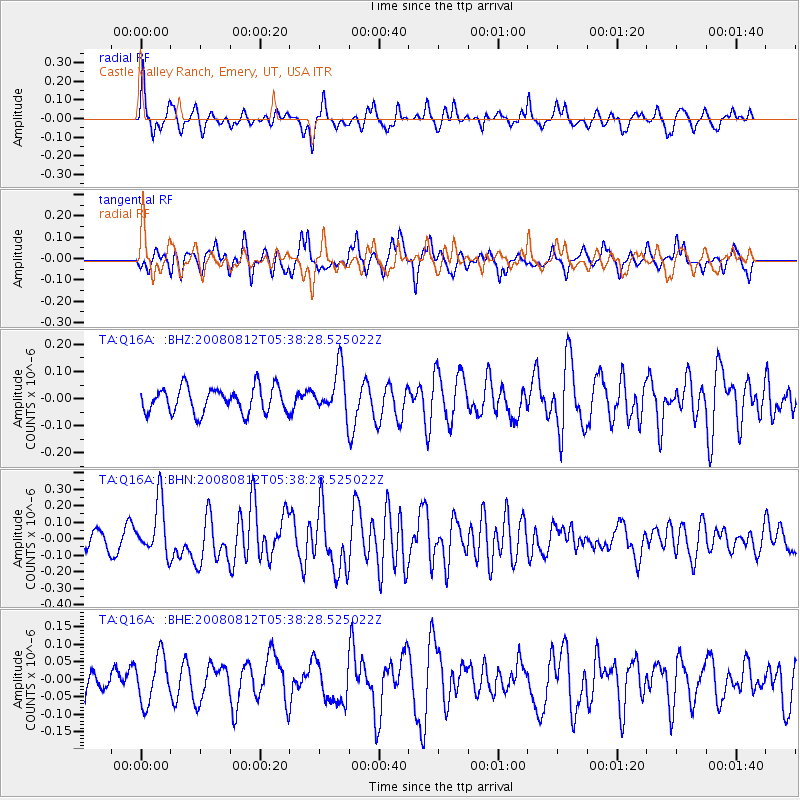
Q16A Castle Valley Ranch, Emery, UT, USA - Earthquake Result Viewer
*The percent match for this event was below the threshold and hence no stack was calculated.
| Earthquake location: |
Santa Cruz Islands |
| Earthquake latitude/longitude: |
-11.4/166.2 |
| Earthquake time(UTC): |
2008/08/12 (225) 05:25:57 GMT |
| Earthquake Depth: |
38 km |
| Earthquake Magnitude: |
5.9 MW, 5.4 MS, 5.2 MB, 5.8 MW |
| Earthquake Catalog/Contributor: |
WHDF/NEIC |
|
| Network: |
TA USArray Transportable Network (new EarthScope stations) |
| Station: |
Q16A Castle Valley Ranch, Emery, UT, USA |
| Lat/Lon: |
38.92 N/111.17 W |
| Elevation: |
1912 m |
|
| Distance: |
91.4 deg |
| Az: |
50.7 deg |
| Baz: |
256.543 deg |
| Ray Param: |
$rayparam |
*The percent match for this event was below the threshold and hence was not used in the summary stack. |
|
| Radial Match: |
76.48373 % |
| Radial Bump: |
332 |
| Transverse Match: |
65.593445 % |
| Transverse Bump: |
393 |
| SOD ConfigId: |
2504 |
| Insert Time: |
2010-03-06 05:50:49.084 +0000 |
| GWidth: |
2.5 |
| Max Bumps: |
400 |
| Tol: |
0.001 |
|
Signal To Noise
| Channel | StoN | STA | LTA |
| TA:Q16A: :BHN:20080812T05:38:28.525022Z | 2.3053262 | 1.6283501E-7 | 7.063426E-8 |
| TA:Q16A: :BHE:20080812T05:38:28.525022Z | 1.1058205 | 6.733169E-8 | 6.0888446E-8 |
| TA:Q16A: :BHZ:20080812T05:38:28.525022Z | 1.8109088 | 8.5056655E-8 | 4.6969046E-8 |
| Arrivals |
| Ps | |
| PpPs | |
| PsPs/PpSs | |


