You are here: Home > Network List > TA - USArray Transportable Network (new EarthScope stations) Stations List
> Station Q16A Castle Valley Ranch, Emery, UT, USA > Earthquake Result Viewer
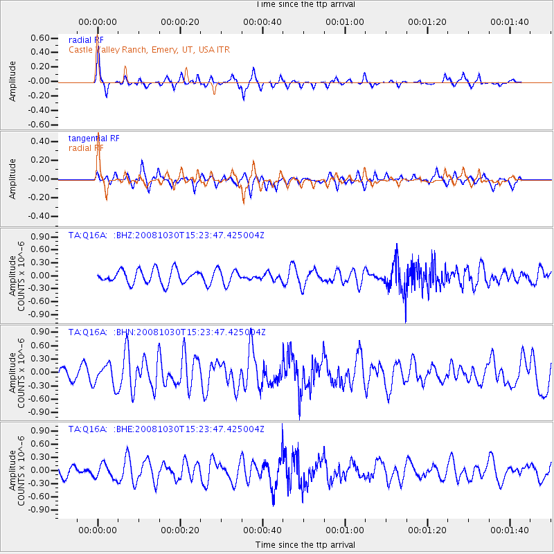
Q16A Castle Valley Ranch, Emery, UT, USA - Earthquake Result Viewer
*The percent match for this event was below the threshold and hence no stack was calculated.
| Earthquake location: |
Central East Pacific Rise |
| Earthquake latitude/longitude: |
-9.0/-108.2 |
| Earthquake time(UTC): |
2008/10/30 (304) 15:15:41 GMT |
| Earthquake Depth: |
10 km |
| Earthquake Magnitude: |
5.5 MB, 5.8 MS, 6.0 MW, 6.0 MW |
| Earthquake Catalog/Contributor: |
WHDF/NEIC |
|
| Network: |
TA USArray Transportable Network (new EarthScope stations) |
| Station: |
Q16A Castle Valley Ranch, Emery, UT, USA |
| Lat/Lon: |
38.92 N/111.17 W |
| Elevation: |
1912 m |
|
| Distance: |
47.8 deg |
| Az: |
356.917 deg |
| Baz: |
176.096 deg |
| Ray Param: |
$rayparam |
*The percent match for this event was below the threshold and hence was not used in the summary stack. |
|
| Radial Match: |
75.789406 % |
| Radial Bump: |
286 |
| Transverse Match: |
56.836452 % |
| Transverse Bump: |
369 |
| SOD ConfigId: |
2560 |
| Insert Time: |
2010-03-06 05:50:59.628 +0000 |
| GWidth: |
2.5 |
| Max Bumps: |
400 |
| Tol: |
0.001 |
|
Signal To Noise
| Channel | StoN | STA | LTA |
| TA:Q16A: :BHN:20081030T15:23:47.425004Z | 2.5456724 | 2.450132E-7 | 9.624696E-8 |
| TA:Q16A: :BHE:20081030T15:23:47.425004Z | 1.7765247 | 1.6533569E-7 | 9.306693E-8 |
| TA:Q16A: :BHZ:20081030T15:23:47.425004Z | 1.0773975 | 1.6825783E-7 | 1.5617063E-7 |
| Arrivals |
| Ps | |
| PpPs | |
| PsPs/PpSs | |


