You are here: Home > Network List > TA - USArray Transportable Network (new EarthScope stations) Stations List
> Station Q16A Castle Valley Ranch, Emery, UT, USA > Earthquake Result Viewer
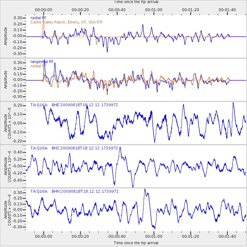
Q16A Castle Valley Ranch, Emery, UT, USA - Earthquake Result Viewer
*The percent match for this event was below the threshold and hence no stack was calculated.
| Earthquake location: |
Solomon Islands |
| Earthquake latitude/longitude: |
-6.6/154.6 |
| Earthquake time(UTC): |
2009/08/18 (230) 17:59:13 GMT |
| Earthquake Depth: |
35 km |
| Earthquake Magnitude: |
5.6 MW, 5.4 MS, 5.3 MB, 5.6 MW |
| Earthquake Catalog/Contributor: |
WHDF/NEIC |
|
| Network: |
TA USArray Transportable Network (new EarthScope stations) |
| Station: |
Q16A Castle Valley Ranch, Emery, UT, USA |
| Lat/Lon: |
38.92 N/111.17 W |
| Elevation: |
1912 m |
|
| Distance: |
97.4 deg |
| Az: |
51.678 deg |
| Baz: |
267.495 deg |
| Ray Param: |
$rayparam |
*The percent match for this event was below the threshold and hence was not used in the summary stack. |
|
| Radial Match: |
46.061535 % |
| Radial Bump: |
400 |
| Transverse Match: |
58.329876 % |
| Transverse Bump: |
400 |
| SOD ConfigId: |
2622 |
| Insert Time: |
2010-03-06 05:51:07.344 +0000 |
| GWidth: |
2.5 |
| Max Bumps: |
400 |
| Tol: |
0.001 |
|
Signal To Noise
| Channel | StoN | STA | LTA |
| TA:Q16A: :BHZ:20090818T18:12:12.173997Z | 1.0279043 | 1.4550088E-7 | 1.41551E-7 |
| TA:Q16A: :BHN:20090818T18:12:12.173997Z | 1.2198037 | 1.2877341E-7 | 1.05568965E-7 |
| TA:Q16A: :BHE:20090818T18:12:12.173997Z | 1.5884203 | 1.5432956E-7 | 9.7159145E-8 |
| Arrivals |
| Ps | |
| PpPs | |
| PsPs/PpSs | |


