You are here: Home > Network List > CI - Caltech Regional Seismic Network Stations List
> Station BAR Barrett, Tecate, CA, USA > Earthquake Result Viewer
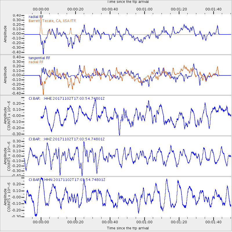
BAR Barrett, Tecate, CA, USA - Earthquake Result Viewer
*The percent match for this event was below the threshold and hence no stack was calculated.
| Earthquake location: |
Southeast Of Loyalty Islands |
| Earthquake latitude/longitude: |
-21.9/169.0 |
| Earthquake time(UTC): |
2017/11/02 (306) 16:51:29 GMT |
| Earthquake Depth: |
5.2 km |
| Earthquake Magnitude: |
5.4 Mww |
| Earthquake Catalog/Contributor: |
NEIC PDE/us |
|
| Network: |
CI Caltech Regional Seismic Network |
| Station: |
BAR Barrett, Tecate, CA, USA |
| Lat/Lon: |
32.68 N/116.67 W |
| Elevation: |
521 m |
|
| Distance: |
89.2 deg |
| Az: |
54.286 deg |
| Baz: |
243.431 deg |
| Ray Param: |
$rayparam |
*The percent match for this event was below the threshold and hence was not used in the summary stack. |
|
| Radial Match: |
44.489277 % |
| Radial Bump: |
400 |
| Transverse Match: |
57.3051 % |
| Transverse Bump: |
400 |
| SOD ConfigId: |
13570011 |
| Insert Time: |
2019-04-29 02:18:59.745 +0000 |
| GWidth: |
2.5 |
| Max Bumps: |
400 |
| Tol: |
0.001 |
|
Signal To Noise
| Channel | StoN | STA | LTA |
| CI:BAR: :HHZ:20171102T17:03:54.74801Z | 1.2214515 | 1.2683137E-7 | 1.038366E-7 |
| CI:BAR: :HHN:20171102T17:03:54.74801Z | 1.833541 | 2.0307755E-7 | 1.1075702E-7 |
| CI:BAR: :HHE:20171102T17:03:54.74801Z | 1.1540822 | 1.2827742E-7 | 1.1115102E-7 |
| Arrivals |
| Ps | |
| PpPs | |
| PsPs/PpSs | |


