You are here: Home > Network List > CI - Caltech Regional Seismic Network Stations List
> Station IRM Iron Mountain Pumping Station, Eagle Mtn., CA, USA > Earthquake Result Viewer
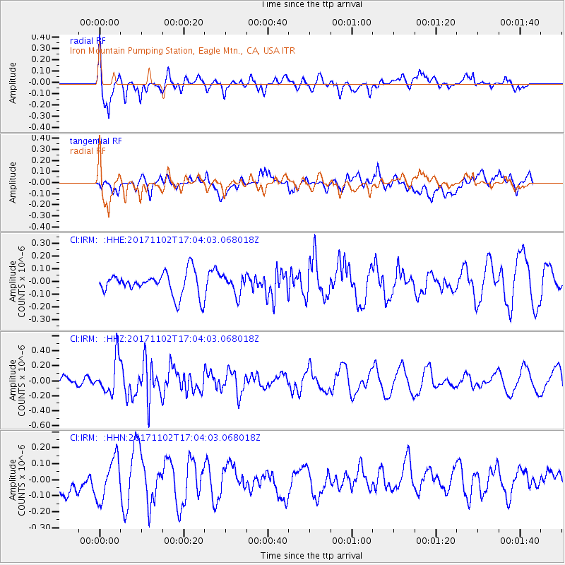
IRM Iron Mountain Pumping Station, Eagle Mtn., CA, USA - Earthquake Result Viewer
*The percent match for this event was below the threshold and hence no stack was calculated.
| Earthquake location: |
Southeast Of Loyalty Islands |
| Earthquake latitude/longitude: |
-21.9/169.0 |
| Earthquake time(UTC): |
2017/11/02 (306) 16:51:29 GMT |
| Earthquake Depth: |
5.2 km |
| Earthquake Magnitude: |
5.4 Mww |
| Earthquake Catalog/Contributor: |
NEIC PDE/us |
|
| Network: |
CI Caltech Regional Seismic Network |
| Station: |
IRM Iron Mountain Pumping Station, Eagle Mtn., CA, USA |
| Lat/Lon: |
34.16 N/115.15 W |
| Elevation: |
567 m |
|
| Distance: |
91.0 deg |
| Az: |
53.527 deg |
| Baz: |
244.27 deg |
| Ray Param: |
$rayparam |
*The percent match for this event was below the threshold and hence was not used in the summary stack. |
|
| Radial Match: |
65.72722 % |
| Radial Bump: |
400 |
| Transverse Match: |
42.00041 % |
| Transverse Bump: |
400 |
| SOD ConfigId: |
13570011 |
| Insert Time: |
2019-04-29 02:19:11.439 +0000 |
| GWidth: |
2.5 |
| Max Bumps: |
400 |
| Tol: |
0.001 |
|
Signal To Noise
| Channel | StoN | STA | LTA |
| CI:IRM: :HHZ:20171102T17:04:03.068018Z | 3.746202 | 2.4006266E-7 | 6.408161E-8 |
| CI:IRM: :HHN:20171102T17:04:03.068018Z | 1.3622147 | 1.2954362E-7 | 9.50978E-8 |
| CI:IRM: :HHE:20171102T17:04:03.068018Z | 0.84312505 | 7.4443584E-8 | 8.829483E-8 |
| Arrivals |
| Ps | |
| PpPs | |
| PsPs/PpSs | |


