You are here: Home > Network List > CI - Caltech Regional Seismic Network Stations List
> Station MPM Manuel Prospect Mine, California, USA > Earthquake Result Viewer
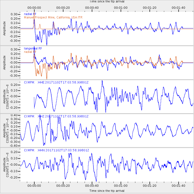
MPM Manuel Prospect Mine, California, USA - Earthquake Result Viewer
*The percent match for this event was below the threshold and hence no stack was calculated.
| Earthquake location: |
Southeast Of Loyalty Islands |
| Earthquake latitude/longitude: |
-21.9/169.0 |
| Earthquake time(UTC): |
2017/11/02 (306) 16:51:29 GMT |
| Earthquake Depth: |
5.2 km |
| Earthquake Magnitude: |
5.4 Mww |
| Earthquake Catalog/Contributor: |
NEIC PDE/us |
|
| Network: |
CI Caltech Regional Seismic Network |
| Station: |
MPM Manuel Prospect Mine, California, USA |
| Lat/Lon: |
36.06 N/117.49 W |
| Elevation: |
185 m |
|
| Distance: |
90.2 deg |
| Az: |
50.974 deg |
| Baz: |
242.955 deg |
| Ray Param: |
$rayparam |
*The percent match for this event was below the threshold and hence was not used in the summary stack. |
|
| Radial Match: |
78.44453 % |
| Radial Bump: |
400 |
| Transverse Match: |
64.42863 % |
| Transverse Bump: |
400 |
| SOD ConfigId: |
13570011 |
| Insert Time: |
2019-04-29 02:19:15.056 +0000 |
| GWidth: |
2.5 |
| Max Bumps: |
400 |
| Tol: |
0.001 |
|
Signal To Noise
| Channel | StoN | STA | LTA |
| CI:MPM: :HHZ:20171102T17:03:58.99801Z | 1.4335251 | 2.0612592E-7 | 1.4378955E-7 |
| CI:MPM: :HHN:20171102T17:03:58.99801Z | 1.1335926 | 6.795917E-8 | 5.995025E-8 |
| CI:MPM: :HHE:20171102T17:03:58.99801Z | 1.102386 | 1.2822333E-7 | 1.16314375E-7 |
| Arrivals |
| Ps | |
| PpPs | |
| PsPs/PpSs | |


