You are here: Home > Network List > TA - USArray Transportable Network (new EarthScope stations) Stations List
> Station M11K Mekoryuk, AK, USA > Earthquake Result Viewer
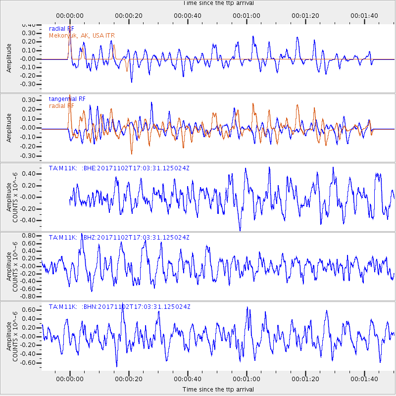
M11K Mekoryuk, AK, USA - Earthquake Result Viewer
*The percent match for this event was below the threshold and hence no stack was calculated.
| Earthquake location: |
Southeast Of Loyalty Islands |
| Earthquake latitude/longitude: |
-21.9/169.0 |
| Earthquake time(UTC): |
2017/11/02 (306) 16:51:29 GMT |
| Earthquake Depth: |
5.2 km |
| Earthquake Magnitude: |
5.4 Mww |
| Earthquake Catalog/Contributor: |
NEIC PDE/us |
|
| Network: |
TA USArray Transportable Network (new EarthScope stations) |
| Station: |
M11K Mekoryuk, AK, USA |
| Lat/Lon: |
60.38 N/166.20 W |
| Elevation: |
3.0 m |
|
| Distance: |
84.4 deg |
| Az: |
12.07 deg |
| Baz: |
203.023 deg |
| Ray Param: |
$rayparam |
*The percent match for this event was below the threshold and hence was not used in the summary stack. |
|
| Radial Match: |
57.11322 % |
| Radial Bump: |
400 |
| Transverse Match: |
56.32754 % |
| Transverse Bump: |
400 |
| SOD ConfigId: |
13570011 |
| Insert Time: |
2019-04-29 02:21:20.910 +0000 |
| GWidth: |
2.5 |
| Max Bumps: |
400 |
| Tol: |
0.001 |
|
Signal To Noise
| Channel | StoN | STA | LTA |
| TA:M11K: :BHZ:20171102T17:03:31.125024Z | 2.972206 | 3.9976368E-7 | 1.3450065E-7 |
| TA:M11K: :BHN:20171102T17:03:31.125024Z | 1.0304554 | 2.239484E-7 | 2.1732957E-7 |
| TA:M11K: :BHE:20171102T17:03:31.125024Z | 0.8367081 | 1.1961659E-7 | 1.4296094E-7 |
| Arrivals |
| Ps | |
| PpPs | |
| PsPs/PpSs | |


