You are here: Home > Network List > TA - USArray Transportable Network (new EarthScope stations) Stations List
> Station Q16A Castle Valley Ranch, Emery, UT, USA > Earthquake Result Viewer
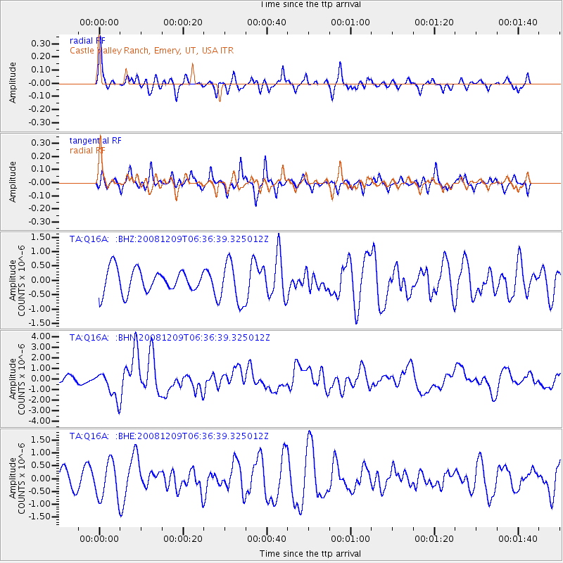
Q16A Castle Valley Ranch, Emery, UT, USA - Earthquake Result Viewer
*The percent match for this event was below the threshold and hence no stack was calculated.
| Earthquake location: |
Kermadec Islands Region |
| Earthquake latitude/longitude: |
-31.2/-176.9 |
| Earthquake time(UTC): |
2008/12/09 (344) 06:23:59 GMT |
| Earthquake Depth: |
18 km |
| Earthquake Magnitude: |
6.2 MB, 6.7 MS, 6.8 MW, 6.7 MW |
| Earthquake Catalog/Contributor: |
WHDF/NEIC |
|
| Network: |
TA USArray Transportable Network (new EarthScope stations) |
| Station: |
Q16A Castle Valley Ranch, Emery, UT, USA |
| Lat/Lon: |
38.92 N/111.17 W |
| Elevation: |
1912 m |
|
| Distance: |
92.8 deg |
| Az: |
45.408 deg |
| Baz: |
231.44 deg |
| Ray Param: |
$rayparam |
*The percent match for this event was below the threshold and hence was not used in the summary stack. |
|
| Radial Match: |
65.16453 % |
| Radial Bump: |
400 |
| Transverse Match: |
40.367157 % |
| Transverse Bump: |
288 |
| SOD ConfigId: |
2658 |
| Insert Time: |
2010-03-06 05:51:50.886 +0000 |
| GWidth: |
2.5 |
| Max Bumps: |
400 |
| Tol: |
0.001 |
|
Signal To Noise
| Channel | StoN | STA | LTA |
| TA:Q16A: :BHN:20081209T06:36:39.325012Z | 4.4712114 | 1.325659E-6 | 2.9648763E-7 |
| TA:Q16A: :BHE:20081209T06:36:39.325012Z | 1.8790525 | 7.344323E-7 | 3.9085248E-7 |
| TA:Q16A: :BHZ:20081209T06:36:39.325012Z | 1.804722 | 7.2159827E-7 | 3.9983902E-7 |
| Arrivals |
| Ps | |
| PpPs | |
| PsPs/PpSs | |


