You are here: Home > Network List > TA - USArray Transportable Network (new EarthScope stations) Stations List
> Station R17K Ugashik Creek, AK, USA > Earthquake Result Viewer
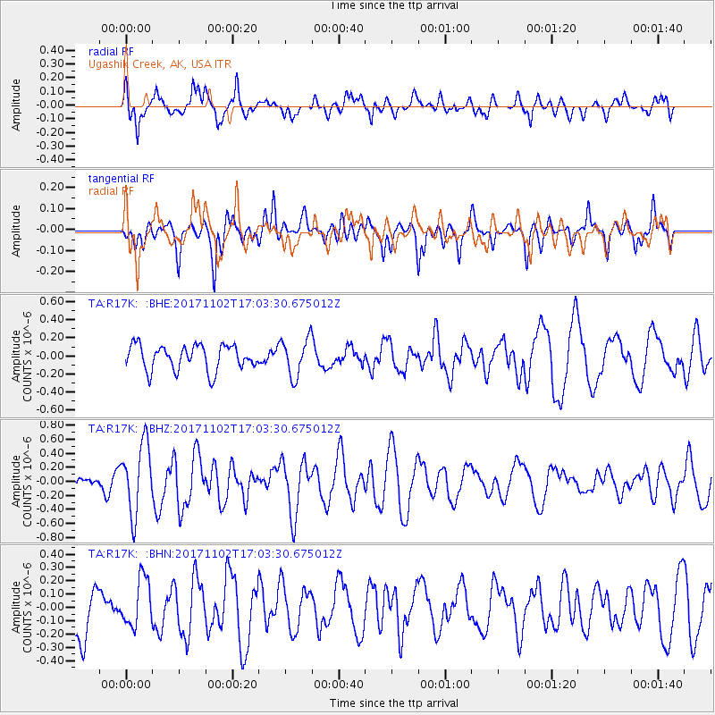
R17K Ugashik Creek, AK, USA - Earthquake Result Viewer
*The percent match for this event was below the threshold and hence no stack was calculated.
| Earthquake location: |
Southeast Of Loyalty Islands |
| Earthquake latitude/longitude: |
-21.9/169.0 |
| Earthquake time(UTC): |
2017/11/02 (306) 16:51:29 GMT |
| Earthquake Depth: |
5.2 km |
| Earthquake Magnitude: |
5.4 Mww |
| Earthquake Catalog/Contributor: |
NEIC PDE/us |
|
| Network: |
TA USArray Transportable Network (new EarthScope stations) |
| Station: |
R17K Ugashik Creek, AK, USA |
| Lat/Lon: |
57.64 N/156.39 W |
| Elevation: |
273 m |
|
| Distance: |
84.3 deg |
| Az: |
17.866 deg |
| Baz: |
212.001 deg |
| Ray Param: |
$rayparam |
*The percent match for this event was below the threshold and hence was not used in the summary stack. |
|
| Radial Match: |
69.80212 % |
| Radial Bump: |
400 |
| Transverse Match: |
62.605244 % |
| Transverse Bump: |
400 |
| SOD ConfigId: |
13570011 |
| Insert Time: |
2019-04-29 02:21:37.635 +0000 |
| GWidth: |
2.5 |
| Max Bumps: |
400 |
| Tol: |
0.001 |
|
Signal To Noise
| Channel | StoN | STA | LTA |
| TA:R17K: :BHZ:20171102T17:03:30.675012Z | 2.736305 | 5.021331E-7 | 1.8350774E-7 |
| TA:R17K: :BHN:20171102T17:03:30.675012Z | 0.96394587 | 1.8216247E-7 | 1.8897583E-7 |
| TA:R17K: :BHE:20171102T17:03:30.675012Z | 1.5165763 | 2.0961463E-7 | 1.3821568E-7 |
| Arrivals |
| Ps | |
| PpPs | |
| PsPs/PpSs | |


