You are here: Home > Network List > TA - USArray Transportable Network (new EarthScope stations) Stations List
> Station R18K Karluk, AK, USA > Earthquake Result Viewer
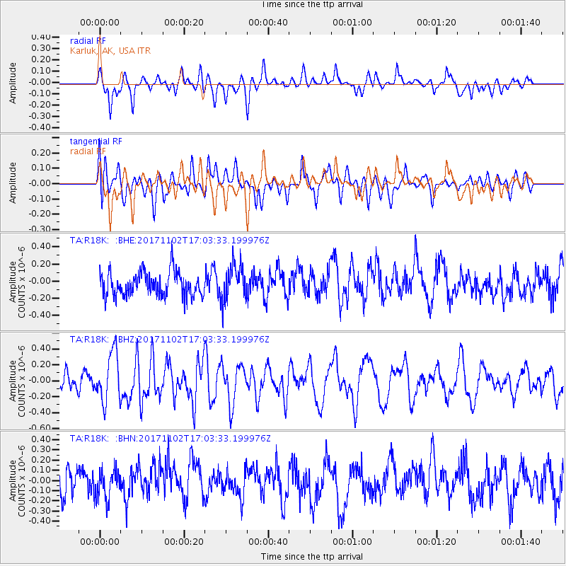
R18K Karluk, AK, USA - Earthquake Result Viewer
*The percent match for this event was below the threshold and hence no stack was calculated.
| Earthquake location: |
Southeast Of Loyalty Islands |
| Earthquake latitude/longitude: |
-21.9/169.0 |
| Earthquake time(UTC): |
2017/11/02 (306) 16:51:29 GMT |
| Earthquake Depth: |
5.2 km |
| Earthquake Magnitude: |
5.4 Mww |
| Earthquake Catalog/Contributor: |
NEIC PDE/us |
|
| Network: |
TA USArray Transportable Network (new EarthScope stations) |
| Station: |
R18K Karluk, AK, USA |
| Lat/Lon: |
57.57 N/154.45 W |
| Elevation: |
39 m |
|
| Distance: |
84.8 deg |
| Az: |
18.785 deg |
| Baz: |
213.718 deg |
| Ray Param: |
$rayparam |
*The percent match for this event was below the threshold and hence was not used in the summary stack. |
|
| Radial Match: |
50.915375 % |
| Radial Bump: |
400 |
| Transverse Match: |
50.123302 % |
| Transverse Bump: |
400 |
| SOD ConfigId: |
13570011 |
| Insert Time: |
2019-04-29 02:21:37.718 +0000 |
| GWidth: |
2.5 |
| Max Bumps: |
400 |
| Tol: |
0.001 |
|
Signal To Noise
| Channel | StoN | STA | LTA |
| TA:R18K: :BHZ:20171102T17:03:33.199976Z | 2.6815372 | 3.1874063E-7 | 1.1886489E-7 |
| TA:R18K: :BHN:20171102T17:03:33.199976Z | 1.1021777 | 1.428064E-7 | 1.2956748E-7 |
| TA:R18K: :BHE:20171102T17:03:33.199976Z | 1.5070266 | 2.0863463E-7 | 1.3844125E-7 |
| Arrivals |
| Ps | |
| PpPs | |
| PsPs/PpSs | |


