You are here: Home > Network List > LD - Lamont-Doherty Cooperative Seismographic Network Stations List
> Station GEDE Greenville, DE, USA > Earthquake Result Viewer
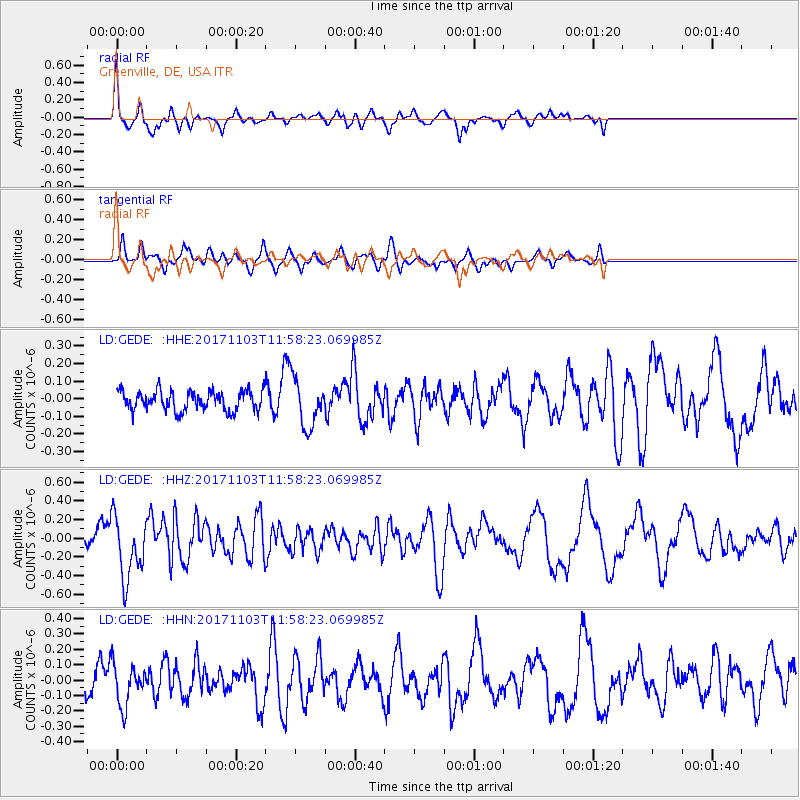
GEDE Greenville, DE, USA - Earthquake Result Viewer
*The percent match for this event was below the threshold and hence no stack was calculated.
| Earthquake location: |
Off Coast Of Jalisco, Mexico |
| Earthquake latitude/longitude: |
18.7/-106.6 |
| Earthquake time(UTC): |
2017/11/03 (307) 11:52:10 GMT |
| Earthquake Depth: |
10 km |
| Earthquake Magnitude: |
5.7 Mww |
| Earthquake Catalog/Contributor: |
NEIC PDE/us |
|
| Network: |
LD Lamont-Doherty Cooperative Seismographic Network |
| Station: |
GEDE Greenville, DE, USA |
| Lat/Lon: |
39.81 N/75.64 W |
| Elevation: |
105 m |
|
| Distance: |
34.0 deg |
| Az: |
45.238 deg |
| Baz: |
240.874 deg |
| Ray Param: |
$rayparam |
*The percent match for this event was below the threshold and hence was not used in the summary stack. |
|
| Radial Match: |
69.52721 % |
| Radial Bump: |
400 |
| Transverse Match: |
61.3004 % |
| Transverse Bump: |
400 |
| SOD ConfigId: |
13570011 |
| Insert Time: |
2019-04-29 02:25:38.718 +0000 |
| GWidth: |
2.5 |
| Max Bumps: |
400 |
| Tol: |
0.001 |
|
Signal To Noise
| Channel | StoN | STA | LTA |
| LD:GEDE: :HHZ:20171103T11:58:23.069985Z | 4.262048 | 3.386671E-7 | 7.9461124E-8 |
| LD:GEDE: :HHN:20171103T11:58:23.069985Z | 1.641297 | 1.3501537E-7 | 8.2261394E-8 |
| LD:GEDE: :HHE:20171103T11:58:23.069985Z | 2.459333 | 1.3740421E-7 | 5.587052E-8 |
| Arrivals |
| Ps | |
| PpPs | |
| PsPs/PpSs | |


