You are here: Home > Network List > TA - USArray Transportable Network (new EarthScope stations) Stations List
> Station J26L Joseph Creek, AK, USA > Earthquake Result Viewer
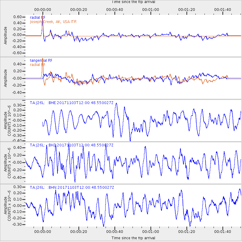
J26L Joseph Creek, AK, USA - Earthquake Result Viewer
*The percent match for this event was below the threshold and hence no stack was calculated.
| Earthquake location: |
Off Coast Of Jalisco, Mexico |
| Earthquake latitude/longitude: |
18.7/-106.6 |
| Earthquake time(UTC): |
2017/11/03 (307) 11:52:10 GMT |
| Earthquake Depth: |
10 km |
| Earthquake Magnitude: |
5.7 Mww |
| Earthquake Catalog/Contributor: |
NEIC PDE/us |
|
| Network: |
TA USArray Transportable Network (new EarthScope stations) |
| Station: |
J26L Joseph Creek, AK, USA |
| Lat/Lon: |
64.50 N/143.56 W |
| Elevation: |
1144 m |
|
| Distance: |
52.0 deg |
| Az: |
340.731 deg |
| Baz: |
133.741 deg |
| Ray Param: |
$rayparam |
*The percent match for this event was below the threshold and hence was not used in the summary stack. |
|
| Radial Match: |
52.85407 % |
| Radial Bump: |
400 |
| Transverse Match: |
46.3443 % |
| Transverse Bump: |
400 |
| SOD ConfigId: |
13570011 |
| Insert Time: |
2019-04-29 02:27:37.607 +0000 |
| GWidth: |
2.5 |
| Max Bumps: |
400 |
| Tol: |
0.001 |
|
Signal To Noise
| Channel | StoN | STA | LTA |
| TA:J26L: :BHZ:20171103T12:00:48.550027Z | 1.8650606 | 2.2396485E-7 | 1.200845E-7 |
| TA:J26L: :BHN:20171103T12:00:48.550027Z | 1.7132174 | 1.1641046E-7 | 6.794844E-8 |
| TA:J26L: :BHE:20171103T12:00:48.550027Z | 0.94950217 | 1.2969153E-7 | 1.3658898E-7 |
| Arrivals |
| Ps | |
| PpPs | |
| PsPs/PpSs | |


