You are here: Home > Network List > TA - USArray Transportable Network (new EarthScope stations) Stations List
> Station P14A Drum Mountains (BLM), Topaz, UT, USA > Earthquake Result Viewer
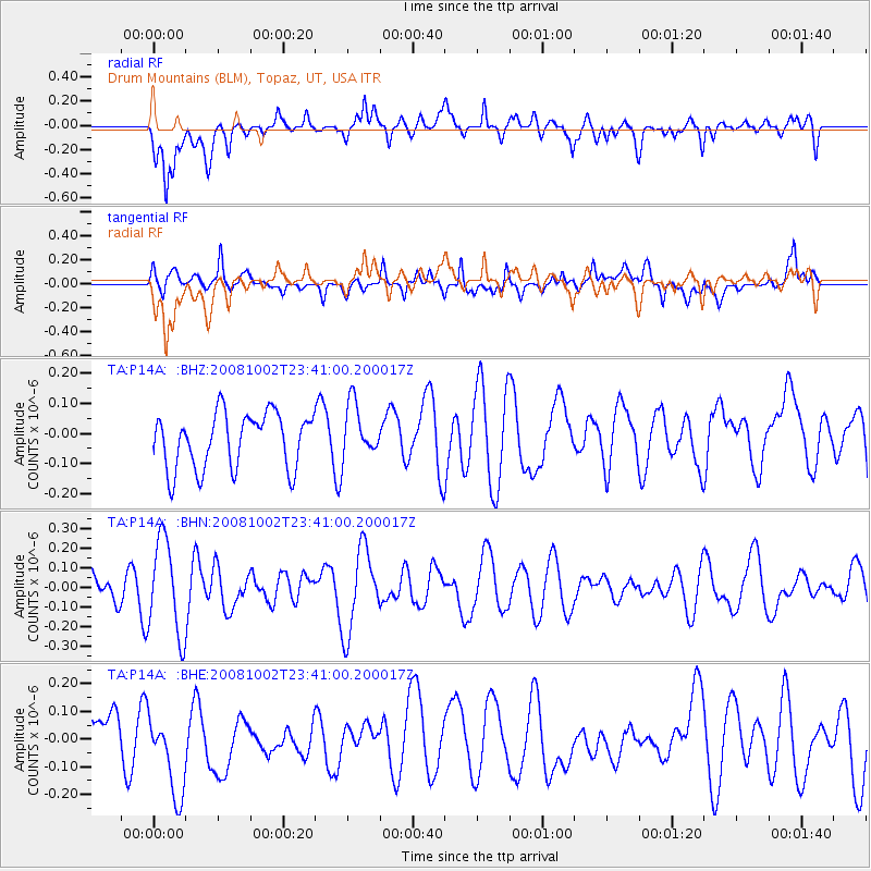
P14A Drum Mountains (BLM), Topaz, UT, USA - Earthquake Result Viewer
*The percent match for this event was below the threshold and hence no stack was calculated.
| Earthquake location: |
Southeast Of Loyalty Islands |
| Earthquake latitude/longitude: |
-23.0/169.9 |
| Earthquake time(UTC): |
2008/10/02 (276) 23:28:09 GMT |
| Earthquake Depth: |
10 km |
| Earthquake Magnitude: |
5.8 MB, 5.5 MS, 5.8 MW, 5.8 MW |
| Earthquake Catalog/Contributor: |
WHDF/NEIC |
|
| Network: |
TA USArray Transportable Network (new EarthScope stations) |
| Station: |
P14A Drum Mountains (BLM), Topaz, UT, USA |
| Lat/Lon: |
39.59 N/113.07 W |
| Elevation: |
1784 m |
|
| Distance: |
95.0 deg |
| Az: |
49.115 deg |
| Baz: |
244.345 deg |
| Ray Param: |
$rayparam |
*The percent match for this event was below the threshold and hence was not used in the summary stack. |
|
| Radial Match: |
57.784397 % |
| Radial Bump: |
400 |
| Transverse Match: |
52.590218 % |
| Transverse Bump: |
400 |
| SOD ConfigId: |
2556 |
| Insert Time: |
2010-03-06 05:54:43.220 +0000 |
| GWidth: |
2.5 |
| Max Bumps: |
400 |
| Tol: |
0.001 |
|
Signal To Noise
| Channel | StoN | STA | LTA |
| TA:P14A: :BHN:20081002T23:41:00.200017Z | 4.341079 | 2.413171E-7 | 5.5589197E-8 |
| TA:P14A: :BHE:20081002T23:41:00.200017Z | 1.638207 | 1.5116815E-7 | 9.227659E-8 |
| TA:P14A: :BHZ:20081002T23:41:00.200017Z | 0.9792072 | 8.9897206E-8 | 9.180611E-8 |
| Arrivals |
| Ps | |
| PpPs | |
| PsPs/PpSs | |


