You are here: Home > Network List > GS - US Geological Survey Networks Stations List
> Station DEC05 Decatur Surface Seismic Site, Decatur, IL, USA > Earthquake Result Viewer
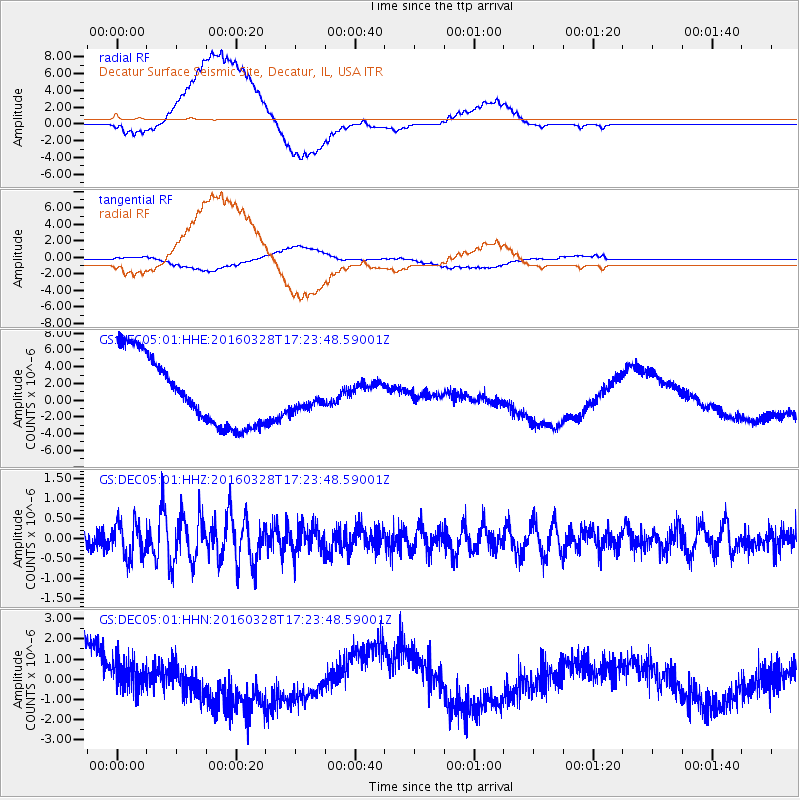
DEC05 Decatur Surface Seismic Site, Decatur, IL, USA - Earthquake Result Viewer
*The percent match for this event was below the threshold and hence no stack was calculated.
| Earthquake location: |
Fox Islands, Aleutian Islands |
| Earthquake latitude/longitude: |
52.3/-168.7 |
| Earthquake time(UTC): |
2016/03/28 (088) 17:14:55 GMT |
| Earthquake Depth: |
10 km |
| Earthquake Magnitude: |
5.5 MB, 5.6 MWC, 5.6 MWB |
| Earthquake Catalog/Contributor: |
NEIC PDE/NEIC COMCAT |
|
| Network: |
GS US Geological Survey Networks |
| Station: |
DEC05 Decatur Surface Seismic Site, Decatur, IL, USA |
| Lat/Lon: |
39.87 N/88.87 W |
| Elevation: |
216 m |
|
| Distance: |
54.0 deg |
| Az: |
69.401 deg |
| Baz: |
311.683 deg |
| Ray Param: |
$rayparam |
*The percent match for this event was below the threshold and hence was not used in the summary stack. |
|
| Radial Match: |
66.23909 % |
| Radial Bump: |
400 |
| Transverse Match: |
52.14153 % |
| Transverse Bump: |
400 |
| SOD ConfigId: |
1475611 |
| Insert Time: |
2016-04-11 17:24:31.513 +0000 |
| GWidth: |
2.5 |
| Max Bumps: |
400 |
| Tol: |
0.001 |
|
Signal To Noise
| Channel | StoN | STA | LTA |
| GS:DEC05:01:HHZ:20160328T17:23:48.59001Z | 1.9929444 | 4.3470524E-7 | 2.1812211E-7 |
| GS:DEC05:01:HHN:20160328T17:23:48.59001Z | 0.49008065 | 1.2457173E-6 | 2.5418617E-6 |
| GS:DEC05:01:HHE:20160328T17:23:48.59001Z | 0.3687494 | 1.4988134E-6 | 4.0645855E-6 |
| Arrivals |
| Ps | |
| PpPs | |
| PsPs/PpSs | |


